The procedure for approving boundaries when surveying a land plot: how to do it without the consent of neighbors
How to carry out land surveying without the consent of neighbors? If the owner ignored the notification received or justified his reluctance to participate in it in the prescribed manner, then land surveying without the consent of the neighbors can be carried out in a simplified form.
This regulatory act states that when clarifying the location of a site, consent to surveying the land plot of the owners of adjacent territories is required if the survey affects boundaries, cadastral information about which has already been previously entered into the state real estate register.
Ways to define boundaries
You can determine the boundaries of the site yourself or with the help of cadastral engineers.
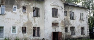
When surveying, neighboring lands must not be affected. This will be regarded as unauthorized seizure, which will lead to legal proceedings.
If no survey was carried out
If measurements have not been taken previously, the boundary is determined by the location of the fences. In the process of determining the boundaries of the territory, the owner sends a request to Rosreestr to receive an extract about the coordinates of neighboring properties in the area.
If surveying has been carried out
You can view the markings of the boundaries of a land plot in Rosreestr, where all data on real estate is stored. To check the measurement parameters, a corresponding application is sent to the Unified State Register of Real Estate.
By cadastral number
To obtain a diagram of the registered territory, you should contact the Unified State Register of Real Estate. You can submit an application for an extract from your land passport in the following ways:
- to the Rosreestr branch;
- through the MFC;
- via mail;
- on the official Internet resource of the USRN.
A sample request form is available here.
The period for consideration of the application and issuance of an extract is 3–5 working days. The citizen is notified when the documents are ready.
On one's own
If there is an agreement with your neighbors, you can establish the boundary lines of your property yourself. This requires:
- determine the dimensions and fix them;
- check for unauthorized seizure of territory by neighbors;
- order a plan drawing service from an engineer.
After receiving the land survey plan, the owner needs to contact the USRN branch to register it.
Act of approval of the boundaries of a land plot - sample and
The chairman and the neighbors are his bosom alcoholic friends who won’t confirm anything in my favor? This is fast and the owners of neighboring territories do not want to appropriately resolve the issue of agreeing on the boundaries of the plots through land surveying? For a clear answer, you need information about what documents you have, is the plot registered in the cadastre, and what right do you have to own your plot of land?
Also, the situation may be complicated by the fact that some of them do not have an email address or the fact that email addresses are impossible to find in the public domain. confirmation of the mistake made is an official document, which is drawn up by a cadastral engineer. Evaluate the 0 -0 earthen survey against the standard of consent of the neighbors of the site. Why is the consent of the neighbors necessary? What needs to be done in order to obtain it? Carry out land surveying, that is, agreement with the neighbors of the boundaries of the site, and if everyone agrees with. Land survey on the basis of the boundary agreement attached to the act , postal notice. The neighbor does not sign the act of approving the boundaries of the land plot.
Coordination of land boundaries with neighbors under the new law
Coordination of land boundaries is a process for cadastral registration. It's a step-by-step process, part of which is coordinating land limits with neighbors.
How to coordinate the boundaries of a land plot with neighbors
Coordination of the boundaries of land strips with neighbors is a procedure that occurs through the signing by neighbors of an act on the coordination of limits. A participant in the process can sign the document individually or in a group meeting of participants in the land surveying process.
A written notification that the coordination act needs to be signed is sent to neighbors a month before the start of the process. The main thing is that the recipient signs the notification.
If he cannot be found, send an advertisement in a state newspaper about a notification addressed to him, in connection with the determination of the boundaries of parts of the site.
The publication and notification contain information about the engineer conducting the process, the date and time, the location of the collection, and the location of land plots with cadastral numbers. If, after the announcement was issued, people did not appear at the meeting, then their signatures are not required. They were notified and did not come, which means they approved the changes.
By the way, there is also an article about the urban planning plan of the land plot.
The procedure for approving the boundaries of a land plot
The procedure for coordinating the boundaries of parts of the land is multi-stage, with the participation of several parties. The process scheme is established in Federal Law ST.39. To carry out the process you need:
- Send an application to the geodetic organization;
- Coordinate the process with the organization;
- Get specialist advice;
- Draw up a contract for approval;
- Notify neighbors a month before the start of work.
They are sent a notice which they sign. On the designated date, an engineer with a completed land surveying scheme holds a meeting with all participants, they sign an approval document.
It is filed and sent to the State Control Committee. There are cases when coordination of the boundaries of a land plot with the owners of other land strips is not required.
The neighbors demarcated their parts of the land, the changes were entered into the Unified State Register of Real Estate.
In this case, the agreement and signatures of neighbors are not required in the act. The entire procedure is carried out by a cadastral engineer, making previously made changes to cadastral numbers. Other participants are notified through an advertisement in official newspapers. If other participants have not sent objections, then by default they accept the changes; the act indicates that there are no claims.
Next, neighbors are notified again to take part in the survey. When the boundaries of their land plots are marked, in the plan the boundaries entered into the State Real Estate Cadastre, those previously entered will be of one color, and the new ones that need to be entered will be of a different color.
By the way, how the redistribution of land plots with municipal land is carried out is described in the next article.
notifications on approval of land boundaries
Boundary approval act: sample
Land Boundary Coordination Document - a paper to indicate the size of a piece of land and its limits. The document is signed by all participants who agree to certain boundaries. Based on the document, updates are entered into the cadastre. The form of the document is established by law; it must contain the following points:
- Personal data of all participants in the process (or authorized representatives);
- Plan of the territory limits;
- Results of the agreement;
- Objections, if any;
- Initials of all participants in the process;
- Personal signature and visa of a cadastre engineer.
The document must be drawn up without blots, corrections (and without cadastral errors) and crossing out. If they are, the document must be printed and signed again.
Coordination of boundaries during surveying
When surveying a land plot, coordination of the boundaries of the land takes place with the participation of several parties:
- owners of the territory;
- Owners of neighboring plots;
- Representative of self-government bodies;
- Cadastre engineer.
After the approval document is signed by everyone, the specialist installs boundary signs on the borders, with signatures about the number and cadastral number. Icons cannot be moved, broken, or painted over. Violators face a large administrative fine. It is also worth reading the article about how exactly cadastral work on land surveying is carried out.
Neighbors do not sign the act of approving the boundaries of the land plot
If for some reason the owners of neighboring territories have objections to the coordination of land areas, then they put them in writing, indicating the reason for the refusal to sign the approval act. To resolve the conflict, the first step is to resort to a peaceful path.
Discuss the problem and come to a compromise. Send a petition to the State Land Land Committee with a request for verification using geodetic instruments. A specialist from the State Tax Committee conducts an inspection and determines which side is violating the borders and who is right. Also send a complaint to the Prosecutor's Office. If the measures do not bring results, contact the magistrates or district court to resolve the dispute.
A claim is filed to resolve the boundary dispute, accompanied by a written refusal from the defendant to coordinate the boundaries. The main thing is to draw up a claim according to its structure, or the judge may refuse to consider it. It sets out a request to establish the boundaries of land surveying, according to geozodic information.
If there were inaccuracies during the survey, then a request is made to recognize the invalidity of the boundaries of another site, and to delete the information from the state cadastre. What documents are needed besides the statement of claim:
- Extracts from the cadastre for your own and neighboring parts of the land;
- Written confirmation of an attempt to resolve the dispute peacefully;
- Examination results;
- Documents for land ownership;
- Cadastral passport and papers for land division;
- Confirmation of violation of rights and interests;
- A copy of neighbors' notices about the land surveying procedure.
Based on the evidence, the court renders a verdict in favor of the right side to determine new boundaries and make changes to the register.
Subscribe to our Yandex.Zen channel
If you have questions, consult a lawyer
You can ask your question in the form below, in the online consultant window at the bottom right of the screen, or call the numbers (24 hours a day, 7 days a week):
- 8
— all regions of the Russian Federation.
Source: https://ahrfn.com/zemelnyj-uchastok/coglasovanie-granic-zemelnogo-uchastka-s-sosedyami-po-novomu-zakonu.html
Land surveying without the consent of neighbors: how to do it
The situation will be different if the neighbor presents a written claim with a notification of refusal to sign the act of coordinating the boundaries, with an explanation of the reasons. Or he will appear at the meeting by invitation and express his complaints and reasons for refusing to sign the agreement.
An appeal to the court will be necessary in case of refusal to sign the act in accordance with motivated claims. If your neighbor becomes the initiator of the claims, you indicate in the statement of claim only the reason for his failure to sign the agreement, and let him deal with his claims independently.
Examples of boundary disputes
Today, practice shows that land surveying aggravates real border disputes and provokes potential disputes.
Here is one example:
The land plot has been registered with cadastral registration and land surveying. Its area has been increased due to the area of the neighboring land plot, where the owner has not appeared for many years. The owner of the second plot did not sign the act of approval of the boundary.
The second owner also decides to carry out land surveying and discovers the boundary incorrectly set by the neighbor. We have a real dispute! It is unlikely that it can be resolved without a judicial procedure, since the first owner took the neighbor’s land deliberately and will not give it up. If his rights had not been registered based on the results of land surveying, then he could still have accepted for execution, for example, an order from the administration of a gardening or settlement, simply by moving the fence.
You are surveying the site. You are not friends with one of your neighbors and this neighbor will not sign a border agreement for you in any case, although you did not violate his interests. Moreover, he will write something similar to a reasoned objection regarding the border. It will be possible to register ownership of such a plot only by presenting a document confirming the resolution of the boundary dispute. In the worst case, we again face the prospect of litigation, which could drag on for many years.
This is interesting: What are the benefits when purchasing a land plot?
What is a land plot plan and its differences from a boundary plan?
The boundary plan indicates only information about the boundaries , which are schematically highlighted on it with a red line. Used when information about the location of their passage is required. Used when marking construction and determining red indentation lines. The same applies when drawing up an act of coordination of boundaries with neighbors or resolving disputes.
The purpose of surveying and drawing up a boundary plan is also focused on determining (restoring) boundary boundaries . But in this case, in addition to the current state of passing the boundaries of the memory, other information is indicated here. For example, when reorganizing a land plot by merging or dividing land, the parameters of previous plots and the boundaries of the newly emerged plot are indicated. The coordinates of turning points and the presence of capital and other buildings on the site are also indicated here.
Boundary disputes between neighbors
› › Contents The Law “On Dacha Amnesty” of June 30, 2006 provides for a number of documents: decisions, certificates, extracts confirming the fact that a land plot has been provided to a citizen.
An important annex to these documents is, which shows in graphical and textual terms all the necessary information about this site. Today, practice shows that land surveying aggravates real border disputes and provokes potential disputes. Here is one example: The land plot is registered with cadastral registration with land surveying.
Its area has been increased due to the area of the neighboring land plot, where the owner has not appeared for many years.
The owner of the second plot did not sign the act of approval of the boundary. The second owner also decides to carry out land surveying and discovers the boundary incorrectly set by the neighbor. We have a real dispute! Hardly
Consent of neighbors to survey the land plot
To reach agreement with neighbors, they need to be in writing. The act of approving the boundaries of a land plot is a standard. The standard for approval of land surveying (approval act) can be downloaded here. So how to carry out (how to do) land surveying without the consent of the neighbors, if it does not seem likely to obtain the neighbors’ signature.
Interesting: Calculation of pay for FSB military personnel from 2019
A property that has been duly registered can be deregistered if its existence ceases, for example, if it is divided into several territories with different owners or merged with another property. Indicate to each of the interested parties the current location of the boundaries of the land plot on the ground. Every individual or legal entity has the right to demand changes and corrections of errors in the state cadastral database. At the same time, it is reasonable to recover from your neighbor changes in accounting records if they include an infringement of your property rights.
Who coordinates boundaries?
The initiators of the approval of the boundaries of a land plot may be:
- owners of adjacent territories;
- owners;
- citizens renting land;
- persons who have rights of perpetual use.
IMPORTANT! When submitting an application for land surveying by a third party, a notarized power of attorney is required to represent the interests of the owner of the site.
Cadastral engineers have the ability to carry out work to establish the boundaries of the territory. But they must have a state license.
Sample consent for land surveying
Answer: Hello, Kirill. According to Art. 11.7 of the Land Code of the Russian Federation, you can use another method of obtaining new land plots - redistribution, and do all the indicated actions - consolidation and further division in one stage.
Redistribution of land plots is another way to create new areas. Article 11.7 of the RF Land Code describes in detail the conditions and procedure for completing this procedure. This method of forming land zones can only be applied to adjacent plots.
Contract for land surveying
- Identification. As a rule, they are served by an internal Russian passport. If his representative acts on behalf of the customer, then a special power of attorney certified by a notary office is required.
- Documents evidencing the applicant's legal right to the property. This could be a gift agreement, a purchase agreement, an inheritance agreement or a certificate. If these papers are lost, measures must be taken to restore them. Without them, it will be impossible to conclude an agreement.
- Extract from cadastral registration. It is issued by Roszemkadastre or the Bureau of Technical Inventory. To do this, you must submit a written request in advance.
- Original cadastral plan of the area.
- Technical documentation for all buildings erected on personal territory. If such papers are missing, then the buildings are considered illegal.
Land surveying is a complex of works and services provided by state and commercial land management organizations that have licenses to carry out such activities. This is a task for which specialists from various fields are involved. Lawyers, cartographers, surveyors, draftsmen and land surveyors are involved in the preparation of official documentation. All of them have the appropriate education and certification to carry out land surveying work.
Interesting: Application for time off on account of unused vacation
How to obtain the consent of neighbors when surveying a plot of land
When going to court, the main reason is indicated as the neighbor’s refusal to sign an act of consent to demarcate land boundaries. This method is effective if there have been no violations during the operation of the territory before. So in court it is possible to achieve land surveying and restoration of the correct boundaries of adjacent areas.
If the neighbors did not express their consent and did not appear to survey the territory, the work can be carried out without them (with proper written notification). All rules must be strictly followed. Only in this case will it be impossible to reclaim the area, since the act will establish that everything was carried out according to the law. The document must be attached to the act of land surveying.
Consent of neighbors to survey a land plot sample
Testimony from neighbors is welcome) carried out land surveying of the site of a two-apartment house and paid for the work. How to separate and privatize a plot of land without the consent of neighbors? Plot, the client is provided with a plan of the land plot on the ground with coordinates, area and deadline. As I understand, you are not the owner of the land, and according to the law, only the owner can make such a claim, but if insults really take place, then you can attract witnesses or make audio or video recordings of this and write a statement to the police or file a lawsuit, for insults, does my neighbor have the right to install a septic tank on the property line and demolish my lawn seedlings? According to snip 2.
You've already remade everything for yourself, so they won't be able to achieve anything. Going to court is the last step, which is permissible provided that preliminary attempts have been made to resolve the situation. So if a neighbor does not agree with the boundary and wants to call surveyors, then agree with him, having previously warned that if you were right regarding the boundary of the plots, then let him pay for the surveying services personally, as the initiator of this dispute. We bought a plot of land that had already been surveyed, but having measured it, it does not correspond to the given dimensions (a little larger).
04 Aug 2020 glavurist 426
Share this post
- Related Posts
- Until what age is the monthly child benefit?
- How to pay a traffic police fine to a pedestrian through Sberbank online
- How does inheritance take place according to law?
- At what distance can you build from the fence?
Consent of neighbors of plot boundaries
Advice from lawyers:
1. The neighbor died. Where can I get a signature for consent to clarify the boundaries of a land plot?
1.1. Wait until a new owner appears...
Did the answer help you?YesNo
Consultation on your issue
8
Calls from landlines and mobiles are free throughout Russia
2. It is possible to privatize a plot of land without the consent of neighbors; the boundaries are divided.
2.1. Ivan, good evening! If it is common property, then it is not possible.
Did the answer help you?YesNo
3. There is no consent of the neighbors to set aside less than one meter from the common border, the house is located on a plot in violation of the plan, the house was built 20 meters more than permitted, communications pass near the border.
3.1. The question is complex. Does the house correspond to the intended purpose of the site? What violations are there besides insufficient setback and an excess of 20 meters? I would like to see your documents for the house and land. I have a lot of experience in this field. I can be useful to you.
Did the answer help you?YesNo
4. I have everything decorated, the main plot and the house. At the neighbor on the right, we amicably and he and I registered the land in front of the houses. And three years later, the neighbors on the left also wanted to register the land in front of the house, the day before we had a fight. I rashly told them that I would not sign my permission to them. Will they be able to register the land without my consent? I heard that they can, but they will have to retreat from my border, how far?
4.1. Without your consent, Rosreestr will not register their land plot. But if they refuse to register, they can go to court, and you will be the defendant in the lawsuit.
Did the answer help you?YesNo
5. There is a house in shared ownership, 1/3 and 2/3. The house stands on both plots and the boundary between the plots (fence) comes into the wall of the house approximately in the middle, into the wall separating the parts of the house. Can we, with the permission of the neighbor, make an extension to the house along the fence, the house in this case will become shaped like the letter “T”. There is no possibility to retreat from the fence the required 3 m. Maximum 1 meter. What documents and where should we formalize the consent and extension, if possible?
5.1. This is a reconstruction and, in addition to the consent of the neighbor, it is necessary to obtain permission for reconstruction in accordance with Art. 51 Civil Code of the Russian Federation. In such cases, it is more convenient to allocate the share in kind, and then attach additional structures. Sincerely, lawyer in Moscow - Stepanov Vadim Igorevich.
Did the answer help you?YesNo
6. Please, can a neighbor put a high fence along the border of the property without my consent, if so, at what distance from the border? Both areas are bordered.
6.1. Uv. Galina, yes it can. But the fence must be perforated or made of Euro picket fence. If he is going to install a “blind” fence from a profile sheet or the like, then your consent is required!
Did the answer help you?YesNo
7. I plan to put up a fence on the border of adjacent plots in SNT Len. areas 1.80 m high from a picket fence, without the consent of the neighbors (the neighbors will not sign the consent) Is this legal on my part?
7.1. SNiP allows only Rabitz mesh.
Did the answer help you?YesNo
8. We bought a house with a plot. The neighbor's garage is located on the border of the property. The previous owner gave consent to the neighbor for construction. Can we now challenge the construction of this garage, since the garage is 4 meters high, 15 meters long with a pitched roof, from which water pours onto our site?
8.1. No you can not. You saw what you purchased and the former owner gave his consent. But you may require a drainage system to be installed so that water does not flood you (if this is true), as well as snow retainers.
Did the answer help you?YesNo
9. The other day, I came home from work. A neighbor came up and said that some person had come and taken measurements of my area along the fence. I purchased a plot of land about 10 years ago and built a house. There are documents for everything, incl. cadastral passport. The neighbors also have documents and the boundaries on the plan have been clarified. I looked on the Internet. Please tell me whether repeated measurements of the site can be made without my consent? What could this mean? There were no conflicts with neighbors. Thank you.
9.1. If there is no conflict with neighbors, then perhaps the local administration conducted a municipal inspection of the use of the land. Especially if it borders on public lands.
Did the answer help you?YesNo
9.2. Hello. Local administration. Install cameras around your home.
Did the answer help you?YesNo
10. Please, I am building a house on my plot, I have taken notarized consent from the neighbors according to the boundary setback from one and from the second neighbor (heir with 1/2 share, since the main owner died), the local administration requires consent for construction from all heirs, for how long Is this legal, because there can be many heirs and they can live in different cities and countries, do I need to look for them and take consent from everyone? Is the consent of one heir with a 1/2 share sufficient? Thank you.
10.1. You don’t have to take consent, as long as there are no later claims from other heirs that you built the house too close without their consent.
Did the answer help you?YesNo
11. If my neighbor’s house is located on the border of the plot, can I build my house three meters from his house or closer with his written consent?
11.1. The distance from the house to the fence between you and your neighbors should not be less than 3 meters. The minimum distance between houses must comply with fire safety standards: -6 meters if the neighboring houses are concrete or brick; -8 meters if the houses have wooden floors (or one is concrete and the neighboring one is wooden); -10 meters if the houses are wooden. Today he agrees, but tomorrow he doesn’t. Today he is your neighbor, and tomorrow another will be a neighbor who does not agree. It is necessary to build in accordance with the standards so that there are no problems with demolition and litigation in the future.
Did the answer help you?YesNo
11.2. Good afternoon. When constructing capital structures, it is necessary to obtain a construction permit. A building permit is issued on the basis of the town planning plan of the land plot, which, in accordance with paragraph 3, clause 3, article 44 of the Town Planning Code of the Russian Federation, determines the minimum setbacks from the boundaries of the land plot in order to determine the permissible location of the building, structure, structure. Since your house was built on a boundary without complying with all sanitary and fire safety standards that determine the appropriate setbacks (for example, SNiP 30-102-99 clause 5.3.2 and clause 5.3.4), then your neighbors and you have a violation of urban planning standards. This, in turn, may entail the initiation of civil proceedings under Art. 222 of the Civil Code of the Russian Federation - Unauthorized construction. There are options for resolving the issue, in terms of incorrectly setting the boundaries of the site, or a cadastral error. But for this I need to see the documents and understand the current problem in detail. I can help you only if your object is located in the Krasnodar Territory. Send available documents to [email protected]
Did the answer help you?YesNo
12. The neighbor asked for permission to build closer than 1 meter from the property line. I’m on bad terms with my neighbor, so I protected myself with different points. I require the consent to be certified by a notary. Does a notary certify such agreements and can I receive this document or is a copy sufficient for me?
12.1. Greetings. The agreement itself will not automatically resolve the neighbor's issue. He will have to contact the administration for permission to violate the rules on setbacks from the property line. You need to decide whether this is for you or not in your best interests. This document is compiled in a single copy. You can obtain a copy certified by a notary.
Did the answer help you?YesNo
13. If I give consent to a neighbor to build 1 meter from the border of my plot, can I demand a ready-made house design to prevent shading of my plot and write in the consent that three of them will not lead to the demolition and dismantling of my buildings standing on the border plot.
13.1. Sure you can. Otherwise, you have the right not to give consent.
Did the answer help you?YesNo
Consultation on your issue
8
Calls from landlines and mobiles are free throughout Russia
14. The neighbor began the reconstruction of the house and laid the foundation 1.2-0.9 m from the border of our site. Requires consent for construction. There is a household on the border. construction of my site 20 years ago. Filed an application with the court for permission to build... threatens to demolish the household. the buildings. Is there a chance to save the building?
14.1. Hello. The first thing you need to have is documents. Confirming the existence of your building for 20 years - these can be old technical passports of the BTI, copies of buildings on the land plot. It is also necessary to clarify when this new owner acquired his ownership. If after you had your buildings on the site, he will not be able to demolish them. Even in court. He saw that he had acquired this building, therefore, the only option he may have is to prove that it violates his rights or poses a threat to the life of him and his family members by being located in close proximity to his buildings. As an option, contact a cadastral engineer and make a cadastral passport for this building and register it with the cadastral register. Then you will further reduce your neighbor’s chances of demolishing it. In addition, you can contact the administration with a statement that your neighbor is building in violation of the law and without permits, as well as in violation of construction and other standards. In addition, the same application must be submitted to the Cadastral Chamber. They conduct an inspection, visiting the site, and based on its results, if violations are identified, he will be held administratively liable and ordered to demolish the building (foundation). This is very brief, but you need to look at the documents - yours, for starters, so that you can give a more complete answer. You are also not deprived of the opportunity to sue your neighbor if his construction is carried out with violations. But this needs to be established. As part of the trial, an examination can be ordered.
Did the answer help you?YesNo
15. The neighbor decided to build a house a meter from the border of the plot. My old farm is located on the border. construction He is threatening to get it demolished through the courts if I don’t sign the consent for construction. What should I do?
15.1. Choose what is cheaper for you.
Did the answer help you?YesNo
16. Reconstructed 1/2 of a private house. Took down the old veranda and storage rooms. I made a warm extension with the consent of the neighbors. I submitted all the documents to the City Administration. The administration refused on the grounds that the neighbor’s town planning standards were violated. No 3 m from the property line. From my side everything is fine. You need to write a statement to the court. Question: only on my behalf or jointly with my neighbor?
16.1. Good afternoon The plaintiff is you.
Did the answer help you?YesNo
17. A neighbor of my land asked me to give my consent to use the land for commercial purposes. The cadastral center said that his land has my address. Despite my objections, the neighbor built his building on the border of our land. And now he is fraudulently trying to legitimize his commercial activities (shops)
17.1. Good evening, yes they can.
Did the answer help you?YesNo
17.2. Hello, Vera. A dispute with a neighbor can be resolved in court. You need a lawyer to look at the documents to understand your situation.
Did the answer help you?YesNo
17.3. Yes, you need to go to court if you built it illegally.
Did the answer help you?YesNo
18. Please, does my neighbor have the right to do something with his garage on my territory (the garage is built on the border of the plots) without my consent.
18.1. You need to look at the documents that show the location of the garage.
Did the answer help you?YesNo
19. I own 1.2 houses on land. He proposed to his neighbor to divide the house into apartments in court. But he refused. I made my apartment in court. And the neighbor built a residential extension along the border of the property. And now. When I put my apartment up for sale. He invites me to legalize his extension. By signing the consent in the documents. Although it is its extension that scares off buyers for my apartment.
19.1. Do not give consent, you can go to court if this is an unauthorized construction.
Did the answer help you?YesNo
20. How to correctly formulate a letter of objection to the City Administration regarding my refusal to allow my neighbor to build a house for non-compliance with the standards by departing from the boundaries of my site.
20.1. This letter is written in free form.
Did the answer help you?YesNo
Our SNT clarifies the boundaries of each plot separately and public lands.
There is a common plot for 3 owners. We reconstructed an old house on our site without permission for reconstruction and now we want to register it.
Non-permanent buildings are located on the border of the plots. When the site was privatized, the neighbor signed a consent; 15 years later he filed a lawsuit for violation of the buildings.
The neighbors privatized the plot adjacent to mine, I did not give any consent to their boundaries.
We built a house with violations of the distance to the boundary line with the neighbors, and a refusal to formalize the completion of construction was received,
Built a garage outside the boundaries of his plot on municipal land in front of the house
Land surveying was carried out in 2007, with coordinates and boundaries defined. The signature and consent of the neighbors is available.
Plot of individual housing construction, size 18 x 6 m. If you build according to the law, then you need to retreat 3 m.
When building an extension to a house along the border of a neighboring plot, what documents are required (consent from the neighbor)
I have a dacha plot, land surveying was done last year, a neighbor built a bathhouse on the borders of the plot and entered my territory, what should I do?
Neighbors in the dacha plot make land surveys and demand that the boundaries be signed,