What is it and why is it necessary?
After the site is depicted on a plan or diagram, it is marked on the ground. This is bringing boundaries into reality. Another name is checking the boundaries of a site on the ground.
The breakdown consists of determining characteristic points - corner points or, as professionals say, turning points - using the coordinates indicated in the document. That is, those where the border of the site makes a turn. In such places they install the so-called. boundary sign - a peg, metal pipe or other mark.
Removing the boundaries of the site in nature is ordered in the following cases:
- It is planned to install a fence or erect a building. So that the object does not have to be demolished later, it is necessary to clarify whether it is really located on its territory;
- the land is sold or otherwise transferred to a new owner. The latter cannot know whether the boundaries of his possessions are correctly marked on the ground, and therefore is interested in checking. This procedure is especially necessary if there are no landmarks such as buildings or fences. The seller is also interested in having a removal certificate: with this document, the plot is more attractive to the buyer;
- boundary signs of the boundaries of the land plot have been destroyed or there is a suspicion that they have been illegally moved. Reconstruction according to documents is required;
- the territory is divided into several parts or, conversely, areas are combined;
- a dispute arose with neighbors (adjacent landowners) regarding the correctness of marking the boundaries of the plots. For example, a neighbor, based on the results of measurements with a tape measure, considers the territory that does not belong to him to be his and has installed a fence on it;
- neighbors are engaged in land surveying of their own properties. Before signing the agreement, it is important to make sure that the boundaries are correctly defined.
Land surveying is the reverse process - documenting data about the boundaries of a site, that is, entering the coordinates of turning points into the Unified State Register of Real Estate and displaying the territory on the cadastral plan. This process is also called cadastral registration.
Restoration of boundary signs, restoration of site boundaries
Restoration of boundary signs is required when they are damaged or destroyed, because the boundaries of the site are strictly tied to these signs.
Restoration of the boundaries of a land plot is a complex of land management work to restore and secure the boundaries of a land plot on the ground with boundary signs, determining its location and area.
If boundary signs on your site are damaged or lost, please contact RIC-GEO. We will restore boundary signs and boundaries of the land plot with the highest accuracy. We work in Moscow and the Moscow region.
Restoration of the boundaries of a land plot is carried out in the following cases:
− destruction or loss
of boundary markers
of land plots; − in case of boundary disputes.
The grounds for carrying out land management work are: − decisions (decrees, orders, instructions) of authorities and local governments on land management; − agreements on land management; − court decisions.
Landmark
Who does the work?
Determining the boundaries of a site is a type of geodetic work. Accordingly, geodetic organizations provide this service. Previously, the position of the direct executor was called “land survey engineer”, after the adoption of Federal Law No. 221 “On Cadastral Activities” - “cadastral engineer”.
The performer is selected according to the following criteria:
- availability of documents confirming the right to engage in this type of work and qualifications;
- service in a long-established geodetic organization. As practice has shown, such specialists perform the work with the highest quality;
- availability of all necessary tools with timely verification documents. Satellite devices are a must;
- reasonable cost of services;
- positive reviews from other landowners.
An important sign of the demand for a cadastral engineer or his company is a website on the Internet with clear prices and a description of the tools available in the arsenal.
What do you need to prepare?
The customer provides the contractor with the following documents:
. This register replaced the State Real Estate Cadastre. The extract contains a plan of the site and the coordinates of its corner points relative to the points of the state geodetic network. This information can also be gleaned from the cadastral extract and boundary plan. The customer receives an extract from the USRN at the nearest multifunctional center (MFC). If he does not have time, the contractor can, for an additional fee, issue an electronic cadastral extract with a digital signature of the responsible person from the cadastral chamber;
fresh extract from the Unified State Register of Real Estate- documentary evidence of ownership of this site , for example, an act on the allocation of land, a lease agreement, etc.
The contractor and the customer enter into an agreement, the text reflects the following data:
- a list of work performed indicating the number of boundary signs to be installed;
- list of documents handed over to the customer;
- turnaround time;
- price;
- liability of the parties for failure to comply with the obligations stipulated by the contract.
Typically, surveying companies take an advance payment of 50% or slightly more of the cost of the service.
Stages of staking out given coordinates of points
As with any geodetic survey, in order to transfer and consolidate design data on the ground, it is important to follow the sequence of work.
The main stages of laying out points on the ground include the following operations:
- the preparatory stage for the removal of data, at which surveyors collect materials on the work object, draw up a plan and approximate deadlines for completing the work, select the optimal methods for this object in order to ensure the required accuracy of the work;
- creation of a geodetic network to which points will be linked when laid out;
- breakdown of benchmarks with interconnected coordinates. Points are fixed on the ground with special marks;
- setting out boundary markers and rotating sections of the boundaries of the object, if the boundaries of the site are being broken down;
- securing designated points on the ground with special signs, marks, pegs, etc.;
- data processing, drawing up a work completion report, issuing a layout report to the customer.
Work order
The removal of site boundaries on the ground is carried out in the following sequence:
The cadastral engineer conducts a geodetic survey and determines the location of boundary points using satellite navigation tools (GLONASS or GPS receivers) and an electronic total station. The latter is a surveying instrument for measuring angles and distances. The reference point for determining points is the nearest point of the state geodetic network. The reliability of the measurements is 5 cm. The accuracy of determining the boundaries is prescribed in the extract from the Unified State Register of Real Estate. Usually it lies within 10-30 cm;- The information collected during field work is processed. If the shape of the site is complex and time-consuming, draw up a technical plan indicating the expected location of the corner points;
- where required, boundary signs are installed. The corner of a building or a fence can be used in this capacity - then no elements are installed. In other cases, pegs or reinforcing bars are stuck into the ground, or fence posts are immediately installed. On an asphalt or concrete surface, a metal mark is placed on the cement mortar. If the customer does not have pegs or fittings, the contractor usually provides them for an additional fee;
- The cadastral engineer draws up an act of removing the boundaries of the site on the ground.
The last stage is called cameral.
Description of land boundaries
Determining the boundaries of a land plot on the ground in accordance with the requirements of land management is a set of works, including: a) creation (restoration) of a supporting boundary network of boundary signs on a given land plot; b) determination, coordination and description of the location of the boundaries of land plots in relation to the objects of the supporting boundary network; c) drawing up a land survey; d) registration of the land plot with cadastral registration.
Types of boundary signs
Types of boundary signs
Types of boundary signs
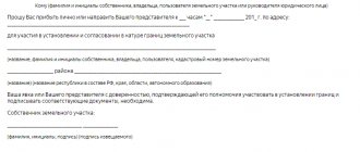
What does the act look like?
The act of removing boundaries indicates:
- extract data from the Unified State Register of Real Estate;
- location of the site (cadastral number and address);
- its area;
- installation diagram of boundary signs;
- information about the owner of the plot.
The document is drawn up arbitrarily, there is no form approved by law. The number of copies is two, both are signed by the customer and the cadastral engineer. One copy is given to the customer.
Additionally, he receives copies of the cadastral engineer’s certificate and certificates of calibration of measuring instruments. There is a possibility that boundary signs will be destroyed or moved.
The act may provide for special recording measures; on this basis, documents are divided into three types:
- indicating coordinates;
- with photo report;
- with a plan for binding boundary points.
With coordinates
This is the simplest option and is issued free of charge. The document form is prepared on site. Disadvantage: in case of damage or unauthorized movement of boundary signs, you will have to order the procedure again.
A simple example of the act of setting out points in real life is possible.
With photo report
There is an additional fee and it takes time to prepare. In addition to the listed data, it contains photographs of boundary signs with number signatures against the background of nearby landmarks. They allow, in case of loss, to approximately restore their location.
With a plan for binding boundary points
This type of act is more expensive than the previous one, but the position of boundary marks is documented in it with absolute accuracy. In addition to photographs, the document contains a diagram depicting the nearest capital objects and the distances from them to boundary signs. If the latter are lost, their location is easily restored.
Expert opinion
Irina Vasilyeva
Civil law expert
In the case of drawing up a simple act of removal without a photo report and linking turning points, the owner is recommended to dig up boundary signs. It will also be useful to photograph them yourself if there are landmarks nearby.
Coordinates of boundary markers
In the process of solving land management problems on your site, the concept of “coordinates of boundary markers” can be presented in several aspects. In a situation where primary cadastration takes place, one of the types of MH is laid at the turning points of the site boundaries; anyone can install it, subject to technical requirements. The next step is to determine the coordinates of boundary markers in the calculation system established in the given area for maintaining real estate cadastre records; for the Moscow region, the local coordinate system MSK-50 has been adopted. For this type of engineering survey, it is necessary to involve surveyors from a company that has SRO approval for the corresponding type of work. The work is carried out using special geodetic instruments, including satellite positioning. The results of calculations are entered into the cartographic and geodetic fund. In a situation where information about the position of boundaries has already been established and registered in the state real estate cadastre, the concept of “coordinates of boundary markers” is used in the context of the fact that this information needs to be found out. Values for the X and Y coordinates can be found in the cadastral passport (state land registration statement) or in the land survey file. In the Moscow region, coordinates can take the form X 4*****,** Y 2******,**, where * is an arbitrary number. If you need to install a fence on your site, but you don’t have data on the boundaries, you can easily contact our geodetic company, and we will quickly and inexpensively purchase documents for you containing information about the exact coordinates.
Price and terms
Field work takes 1 day. But due to the large queue of customers, departure is often delayed for several days. It takes 1-2 days to prepare a boundary demarcation report with a photo report or a point-referencing diagram.
The cost varies greatly. It depends on the number of boundary signs, the distance and size of the site, and the urgency of the work. There is no fixed rate; each company sets its own price.
To determine the location of one boundary sign they ask from 500 rubles. up to several thousand. Thus, Moscow companies charge from 6 thousand rubles for installing 1-4 signs on an area no further than 20 km from the Moscow Ring Road. Each subsequent sign costs 500 rubles. The cost of a photo report is 3-4 thousand rubles. For an act with a scheme for linking points, an additional 6-8 thousand rubles are charged.