Combining land plots is quite simple if you know some of the nuances and contact a well-established geodetic company that has been working in the geodetic services market since 2000. Our cadastral engineers were among the first to receive certificates and have proven themselves well in cadastral activities. Contact our company - and you will not regret it!
In this article we will analyze all the nuances and subtleties associated with the consolidation of land plots.
By combining land plots into one we mean a legally formalized procedure for obtaining one plot from several adjacent ones. Accordingly, these changes are fixed in new documents, in cadastral registration and on the ground. First things first.
What does the boundary plan for the merger of storage units look like?
Due to recent changes in legislation, the cadastral chamber accepts boundary plans (as well as technical ones) exclusively in electronic form. Because of this, the procedure for accepting documents at Rosreestr has been simplified and the queues have become shorter.
Now boundary plans look like XML diagrams that are inaccessible to the uninitiated person. And sometimes it’s not easy for initiates to adapt to the ever-changing patterns dictated by representatives of the cadastral chamber. But this is no longer relevant.
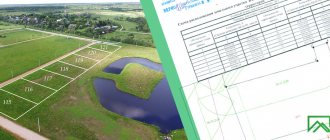
In paper form, the boundary plan is issued to the Customer only for visual acquaintance with the contents and then only by prior agreement. An approximate view, so to speak, a sample, can be seen on the slider on the left. This is approximately how the interplane will be displayed by Rosreestr employees when processing an application for the consolidation of land plots.
Who carries out the merger of plots and what document prepares?
This procedure is included in the list of works related to land surveying. It follows from this that the merger is carried out by a cadastral engineer. To make changes to the real estate cadastre, he prepares a boundary plan. By clicking on the link, you can read a brief description of this document, its purpose and much more.
Next we will talk about a specific type of boundary plan - to combine land plots into one.
Important points
Land plots can not only be divided legally, but also united through the procedure of forming an integral territory. The legislation establishes that the relevant activities relate entirely to work in the cadastral field. Consequently, the merged areas cease to exist as independent units.
The nuances of carrying out the procedure under consideration are fully enshrined in Article 11 of the Land Code of the Russian Federation. Only those lands that are located next to each other can be merged. Otherwise, the merger cannot be completed under any circumstances.
Article 11. Powers of local government bodies in the field of land relations
In cases where one specific person acts as the actual owner of several plots, then he receives the sole right to complete disposal of the newly formed object. However, if there are several owners, then during the merger, shared ownership is formed.
Sample application for consolidation of land plots:
What work does a cadastral engineer do during a merger?
The merged plots must be registered in the cadastral register. That is, all data about their boundaries can be obtained from Rosreestr. The cadastral engineer does not need to go to the area and take measurements, which significantly reduces the cost of this type of work. The engineer’s task is to receive and study the documentation provided by the customer of the work, order cadastral information and prepare a boundary plan.
In fact, the cadastral engineer checks whether the plots can be combined and draws up a boundary plan for the formation of a land plot by merging.
Why do you need to merge land plots?
This question may take many people by surprise. After all, it often happens that the same person owns several adjacent plots that have different documentation and cadastral numbers. This is possible for various reasons, and sometimes it is not the desire of the owner, but a forced decision when the plots cannot be combined. But more on that below.
If legally the plots can be formed by merging, then this is done for the following reasons:
- if the owner has tax benefits in relation to the land plot, then they will not apply to the second and subsequent ones. Therefore, it is more profitable to have one plot, which will be taxed on preferential terms.
— it is impossible to obtain a building permit and generally register a house if it is located on several plots of land.
- the price per hundred square meters increases. For example, selling two adjacent plots separately will be cheaper than one with their total area.
— there is no need to duplicate documents, which is easier when dealing with the legal movement of land.
— land tax is calculated per plot, and the owner ultimately pays a smaller amount.
Association with one or more owners
There are two options for combining adjacent land plots - if they belong to the same person or to different people.
In the first case, everything is quite simple - the owner of the merged plots will have ownership rights transferred to the resulting large plot. But you need to remember that all the encumbrances that one or more plots had before the merger will be completely transferred to the merged one. This also applies to plots that are pledged. Such areas can also be combined. If you combine one mortgaged plot with a plot without encumbrance, the resulting plot will also be mortgaged.
In the second case, when the owners are different, it turns out differently. Naturally, restrictions and encumbrances also transfer to the combined site. But after the merger procedure, all former owners of individual plots will have the right to common ownership. That is, after registering the plot, each owner will have his share indicated in the new certificate. It is also worth noting that the number of merger applications (see documents) must correspond to the number of owners.
I would like to note that sometimes after a merger, in cases established by law, the resulting land plot may lose some restrictions or encumbrances. It is better to discuss these cases with a qualified specialist from our company.
Comprehensive legal assistance
A highly qualified land lawyer will help the client solve many problems that he is unlikely to cope with on his own. An experienced lawyer is called in when the problems are related to:
- with the establishment and registration of ownership of the site;
- with the division of land holdings or with the consolidation of individual real estate;
- with support of transactions related to land use;
- with the establishment of a procedure for the use of common land ownership for co-owners;
- with registration of easement;
- with land surveying;
- with document restoration;
- with disputes arising between the tenant and the landlord;
- with the removal of obstacles to the use of land;
- with determination of its cadastral value;
- with privatization;
- with a change in the category of land, if the designated plot should become part of the common land ownership.
Also, a competent professional will help solve other problems in 2018. If necessary, he will prepare documents to submit to the court to challenge the initial court decision.
In addition, it will help resolve conflict situations that may arise between persons claiming certain disputed territories. After all, only those plots that are not officially claimed by other persons are allowed to be united into a single plot.
Necessary conditions for merging plots
There are quite a lot of conditions and it is worth going into detail about each of them:
| The plots must have a common border with a distance no less than the norms established by the Law, that is, they must be adjacent |
| The original land plots must be registered in the cadastral register and their boundaries must be determined in compliance with accuracy standards. This parameter can be viewed in the cadastral extract in section KV.6. Otherwise, it is necessary to first prepare a boundary plan to clarify the boundaries, make changes to the cadastre based on it, and only then begin to form a land plot by merging. First of all, this concerns owners of land plots in New Moscow. Being the Moscow region, the accuracy of determining the location of boundary signs was 0.3 m. Now it is 0.1 m - now this is Moscow. So it turns out that almost all sites in this area do not meet the standard accuracy |
| The resulting site must comply with the maximum site size standards established by local governments, if any, for this type of permitted use |
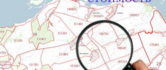
| The original plots must have the same type of permitted use (LPH, gardening, individual housing construction, etc.) and, accordingly, the category of land (settlement lands, agricultural purposes, etc.). They must also belong to the same administrative-territorial entity. To put it simply, they must be located in the same cadastral quarter. This information can be found on the public cadastral map |
| The consent of the owner(s) of the original plots for the merger is required, confirmed in writing in the application for merger |
If all these conditions are met, you can proceed.
How the procedure works
In 2020, the procedure is carried out in several stages:
- Collection and correct preparation of the installed documentation package.
- A visit to the territorial cadastral chamber followed by calling an authorized cadastral engineer to the site - the specialist will carry out the necessary measures, as a result of which all technical papers will be issued to the owner.
- Registration of the formed land plot with the subsequent assignment of an individual cadastral code.
- Registration of a new certificate of ownership.
- An application to the local registration authority, whose employees are engaged in issuing a unified application - it must be signed by the interested citizen, taking into account the attachment of additional papers.
Types of ownership of land plots depend on their purpose and use.
Where to find out the size of a land plot by cadastral number - see.
The title document for the territorial allotment will be issued to the owner within the established period of 30 calendar days.
Required documents
To register a new plot of land for cadastral registration, the following documents will be required, the current list of which is regulated by Federal Law No. 218:
- an application requesting the organization of cadastral registration;
- agreement concluded between the owners upon the fact of the merger;
- documents of title to the original plots, if the official ownership of them has not been registered in a unified register.
If the boundary plan was previously placed in the archives of the competent authority without the possibility of receiving it in person, then you can find out the identification code of this document. Providing such numbering eliminates the requirement to present a classic plan.
If the application is handed over to an employee of the registration department, then the direct applicant must present his civil passport, and, with the participation of his official representative, a notarized power of attorney confirming the authority of a specific person.
Registration in Rosreestr
The application, along with the accompanying package of documentation, must be submitted to the territorial branch of the state register in one of the ways clearly prescribed in Federal Law No. 218 and in a special Procedure approved by Order of the Ministry of Economic Development of the Russian Federation No. 883 dated November 26, 2015.
The transfer of documents is carried out by a person to the direct branch of Rosreestr, or to the Multifunctional Center. Binding to the actual location of the land is not of decisive importance, thanks to the reception of the package on an extraterritorial basis. Among other things, the application can be submitted to an authorized representative of the cadastral registry in the format of an on-site reception.
Another possibility is to transfer the completed set of documents by post with a declared value, a list of enclosed papers and a notification of receipt. A personal account on the official website of the state register can also be used to achieve the goals under consideration.
If at the time of filing the application the state duty has not been paid, then the applicant is provided with information about the individual codification of a specific payment order. Payment of the fee is carried out taking into account the indication of the actual date. The requirement for this is contained in the Rosreestr Information dated July 26, 2020.
The period for carrying out the procedure within the framework of cadastral registration and state registration of property rights is 10 working days from the date of acceptance of the application documentation for processing by the territorial branch of Rosreestr. If a set of papers is submitted in one window mode at the Multifunctional Center, then the established time frame changes to 12 working days.
Officially, state registration begins to operate from the day the documentation is received. The provision on this is contained in Federal Law No. 218. It is worth noting that simultaneously with the registration of ownership of the newly formed territorial allotment, the termination of the rights to use the original plots of land will be registered, which, in turn, is regulated by Article 41 of the above Law.
Each interested person can receive comprehensive information about the progress of the event, for example, about the transfer of state duty payments, through electronic mailing to the email address specified in the application. For these purposes, a mobile phone number can also be used, which is clearly stated in paragraphs 3 and 4 of the Procedure from the Ministry of Economic Development of the Russian Federation dated March 16, 2020.
Documents required for merger
To carry out the procedure for merging land plots, you must provide the following documents:
— application/s about the merger (filled out in any form)
Example of a merger statement⇒
— title documents for the plots (state registration certificate or extract from the Unified State Register)
— cadastral extract of land plots (if available)
These documents are sufficient to prepare a boundary plan.
Legal requirements for allotments
The consolidation of land plots with different permitted uses is carried out only taking into account legal norms. The procedure has a number of specific requirements, failure to comply with which the event will be considered illegal.
Among the fundamental conditions it is worth highlighting the following:
- the areas that the interested party plans to combine must necessarily be adjacent;
- it is mandatory to establish their specific boundaries - in other words, land surveying is required with the entry of current information into the cadastral register;
- the merged lands must fall under the same category, however, in some cases, different formats of permitted use are allowed - this is due to the fact that the owner is given the opportunity to independently set the type for the formed property;
- the combined territorial plots must be located within the same municipality;
- plots of land owned by citizens on the basis of perpetual use or inheritable ownership can be united only if they have one single owner;
- if any construction objects are located on the sites, then they must be preserved in the same form as during the procedure;
- the formed site should not under any circumstances interfere with the construction of new construction projects;
- the new territory should not lead to a change in the border or its wedging into other lands;
- the event cannot contradict the norms of current federal legislation.
Cost of drawing up a boundary plan for merging a land plot
As mentioned above, most often measurements on the ground are not needed for this type of boundary plan. This means the cost of work will be significantly lower. However, you should not chase cheap offers on the geodetic services market. After all, land is becoming more and more expensive, and mistakes in its design may not be worth the cost of the work.
Our company will prepare a boundary plan for the consolidation of a land plot in Moscow and the Moscow region from 8000 rubles .
It is also worth warning you against ordering work from unscrupulous companies. There they measure some, draw up others, sign others. And responsibility for land surveying lies entirely with the cadastral engineer who signed the land survey plan. When something is wrong with the boundary plan, you go to the company where you ordered it. So, in one-day companies the following scheme is carried out to deceive customers. When you come there and demand that the work be redone, you will be told that all questions should be addressed to the engineer who signed up for the interplan, and the company does not bear any responsibility. But the engineer himself can be physically located even on Sakhalin. That is, the document is prepared by representatives of the company, and the seal is affixed by an “incomprehensible” engineer. And all claims and lawsuits must be sent far to the East. Therefore, be careful and check who draws up this document. It is advisable that the engineer be physically located at least in your region.
Even if you do not dare to contact our company, do not fall for big discounts and super-profitable offers - most likely these are scammers or unscrupulous performers. Quality work will not cost very little.
Prices of our services


