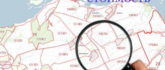
Demarcation of the boundaries of a land plot - how much effort, time, nerves and financial investments are associated with this process. It is good if, during geodetic activities, the real size of the site coincides with the documented one. And if “no,” what will happen when a discrepancy between the official document and reality is discovered? Any change in area, be it an increase or decrease, entails additional paperwork. For example: during land surveying, the area turned out to be smaller, what should I do?
At first, this issue seems insoluble and entails a waste of a lot of time, money and nerves. But in fact, everything is much simpler. The legislation of our state provides for an anemic option for resolving this issue. There are, of course, exceptions and conditions everywhere that must be met to obtain a positive result. It also depends on the reasons why there was a discrepancy in size and boundaries.
How to fix a technical error when overlaying land plots
Both the owner of the plot and any interested person can apply for correction of such an error (Part 1, Article 61 of the Law on State Registration of Real Estate). For example, the owner of an adjacent plot who, in order to carry out land surveying of his plot, needs correct information about the neighboring plot.
To correct a technical error you need to:
- fill out an application (Part 1 of Article 61 of the said Law). If submitted in person, it can be completed by a specialist accepting documents (clause 6 of the Requirements given in Appendix No. 4 to Order of the Ministry of Economic Development of Russia dated December 8, 2015 N 920).
The application is drawn up in the form given in Appendix No. 2 to the said Order. The detailed procedure for filling out each detail (column) of the application is contained in the specified Requirements. Please pay attention to filling out details 3.1.2. In it, depending on which of the registers the error was made, the sign “V” should be about or “in the information of the border register” and fill in the appropriate columns, including reflecting the information with the error and the correct data;
- apply . It is submitted in the same manner as for state registration of rights to real estate.
Note that this error can also be corrected if it is detected by the rights registration authority or by court decision (Part 1 of Article 61 of the Law on State Registration of Real Estate).
How is the overlap of land boundaries identified?
Detection of the fact of overlapping boundaries of adjacent plots usually occurs at the moment:
- carrying out land surveying work (which is carried out at the time of registration, consolidation, redistribution or division of land ownership);
- when registering real estate.
If an overlap is discovered during land surveying, the cadastral engineer draws up a conclusion that reflects the detected error and indicates which plot boundaries were violated, as well as why this happened. If the discovery occurred during registration, then the specialists of the competent authority make a decision to suspend or refuse to register the property due to the fact that a cadastral error has been identified.
The basis for pre-trial or judicial consideration of the issue can be either a conclusion drawn up by an engineer or a refusal issued by the Rosreestr authority.
How to fix a registry error when overlaying land plots
Such an error is corrected by the state registrar only if documents are received that indicate its existence and contain information necessary to correct it, or a court decision that has entered into legal force (Part 3 of Article 61 of the Law on State Registration of Real Estate).
The error can be corrected either at your request or without your participation, if it is corrected during complex cadastral work or independently identified by the rights registration authority.
How you can fix the registry error yourself
This is interesting: State duty to clarify the boundaries of a land plot
The order of your actions will depend on the area in which the error was made.
If an error is identified in relation to your plot of land and another plot overlaps it (that is, the boundaries of the plot belonging to you are incorrect), you can correct it yourself.
To do this, you first need to contact a cadastral engineer or the organization where he is an employee and enter into a contract agreement to perform cadastral work. The cadastral engineer will draw up a boundary plan, which will indicate that it was prepared in connection with the correction of an error (Part 1 of Article 35 of the Law on Cadastral Activities, Clause 27 of the Requirements approved by Order of the Ministry of Economic Development of Russia dated December 8, 2015 N 921).
After this, submit an application for cadastral registration to Rosreestr in the cadastral chamber in connection with the change in the description of the location of the boundaries of the land plot and attach to it a new boundary plan, on the basis of which the changes will be made. In this case, an application to correct the error is not submitted. It will be corrected by clarifying the boundaries of the land plot (clause 7, part 2, article 14, part 1, article 43 of the Law on State Registration of Real Estate).
Documents are submitted to Rosreestr in the same manner as for state registration of rights.
If an error is detected in relation to an adjacent plot on which your plot overlaps (that is, the boundaries of the adjacent plot are incorrect), then you will not be able to correct the error yourself. To do this you need to contact:
- to the owner of the land plot on which the boundaries of your plot are superimposed. If he agrees that the boundaries of his plot are incorrect (erroneous), then you need to contact a cadastral engineer or the organization in which he is an employee. In this case, one boundary plan will be prepared for your land plot and an adjacent one, in relation to which the boundaries will be clarified (Part 1 of Article 35 of the Law on Cadastral Activity, Clause 20 of the Requirements approved by Order of the Ministry of Economic Development of Russia dated December 8, 2015 N 921).
After preparing the boundary plan, contact Rosreestr for cadastral registration of your land plot;
- to court if it is not possible to reach an agreement with the owner of the adjacent plot.
How to fix a registry error without your participation
Correcting such an error without your participation is possible in the following cases:
- when carrying out complex cadastral works . Such work is carried out by order of local government bodies of a municipal district (urban district), and in Moscow, St. Petersburg and Sevastopol - by executive authorities of these entities. As a result of these works, the boundaries of land plots are clarified and registration errors in information about their boundaries are corrected (Part 2 of Article 42.1, Part 1 of Article 42.2 of the Law on Cadastral Activities).
Based on the customer’s application and the map plan of the territory, which is compiled based on the results of complex cadastral work, the boundaries of land plots will be clarified in the Unified State Register of Real Estate (Part 3 of Article 19, Part 3 of Article 43 of the Law on State Registration of Real Estate, Article 42.4 of the Law on cadastral activities);
- if the rights registration authority has identified the error independently . In this case, he makes a decision on the need to eliminate it and sends it to interested parties (authorities) no later than the next working day. The decision will indicate the essence of the error and the need to correct it (Part 6 of Article 61 of the Law on State Registration of Real Estate).
When you receive such a decision, evaluate whether you need to correct the error, as this may incur additional costs. If you decide to correct it, then you need to contact a cadastral engineer and then Rosreestr.
After six months from the date on which the decision was sent, the rights registration authority may make changes to the Unified State Register of Real Estate without the consent of the legal owner of the land plot in the following cases (Part 7 of Article 61 of the said Law):
- if the documents necessary to correct the error (the information contained in them) have not been received;
- documents for cadastral registration of changes in order to correct the error were submitted, but their registration was refused.
Changes can be made if after this the area of the land plot does not differ from its area indicated in the Unified State Register of Real Estate by more than five percent (Part 7 of Article 61 of the said Law).
It should be noted that in practice, difficulties arise when making such changes to the Unified State Register. Thus, new coordinates of characteristic points of the boundaries of the land plot, which may be unknown, must be entered into the register. At the same time, Rosreestr does not always have the opportunity to establish them, since the procedure for their independent determination has not been established for registration authorities.
This is interesting: Tax on shares of agricultural land
What is a survey error?
Land surveying means work to establish or restore the boundaries of a land plot on the ground, secure them, and determine its location and area. This is one of the most complex land registration processes included in cadastral and land management work. Land surveying involves determining the scale and boundaries of the site, linking the cadastral plan and the geographical location of the site to the area (marking boundaries in nature), as well as consistent legal registration of all relevant documents.
The Federal Law of the Russian Federation calls a survey error (cadastral error) an error in the document on which information was entered into the state cadastre.
How to know if the error has been fixed
The rights registration authority will correct:
- technical error - within three working days from the date of receipt of the application or court decision or its discovery (Part 1 of Article 61 of the Law on State Registration of Real Estate);
- registry error - within five working days from the date of receipt of documents indicating its existence and containing correct information, or a court decision that has entered into legal force (Part 3 of Article 61 of the said Law).
Notification of error correction is sent to the copyright holder (right holders) within the following terms (parts 1, 5, 8 of Article 61 of the said Law):
- within three working days after the error is corrected;
- within five working days if Rosreestr corrected the registry error independently.
As a general rule, notification is sent to the email address specified in the application by indicating a link to an electronic document posted on the Rosreestr website. If the error was corrected without a statement, the link is sent to the email address contained in the Unified State Register of Real Estate. A paper notification will be sent only if there is no email address in the application or the Unified State Register. In this case, it is sent by mail to the address specified in the application, and if the error was corrected without an application, then to the address available in the Unified State Register (Clause 4 of the Procedure given in Appendix No. 1 to Order of the Ministry of Economic Development of Russia dated March 25, 2016 No. 173, clause 5 of the Procedure given in Appendix No. 2 to the said Order).
What errors do you encounter?
When establishing the boundaries of a land plot, the most common error is when determining the boundaries of a land plot , which was later entered into the land cadastre.
According to the Federal Law on Cadastre, the boundaries of a land plot are specified in accordance with the information contained in the title document; in the absence of such - on the basis of documents that defined the boundaries when the site was formed. If these documents are also missing, the boundaries of the land plot are considered to be those that have existed for at least fifteen years and use artificial or natural objects as landmarks.
Another common cadastral error (error during land surveying) is the discrepancy between the boundaries of the plot indicated in the state cadastre and the actual boundaries of the land plot. This discrepancy may look like a general displacement of the cadastral boundaries in relation to the actual ones along the entire perimeter, due to an error in the coordinates of the turning points of the site.
Often, an error during land surveying looks like an overlap of the taken into account boundaries of the site onto the boundaries of existing structures .
How to check the correctness of the boundaries they define?
We ordered land surveying in adjacent areas; land surveying was carried out earlier. Is it necessary to invite neighbors and sign a deed from them? approvals and also ordered land surveying, according to them, our site is far removed from its actual location on the public cadastral map, the cadastral engineer says that their measurements are correct, and the boundaries of other sections of our street are incorrectly defined. I think the boundaries of the site are defined incorrectly! What to do? We do not have any border overlay, since it is shifted to free space. But almost half of the site is shifted on the public map beyond our fence. How to check the correctness of the boundaries they define?
Grounds for going to court when imposing boundaries of land plots
According to the norms of the current Russian legislation, the resolution of such issues falls within the competence of courts of general jurisdiction. Address the statement of claim to the district court, based on the location of the land ownership.
Read more: When do you need a notary for real estate transactions?
Situations in which a case is subject to consideration in court proceedings may be as follows:
- the presence of a dispute regarding boundary boundaries between owners of adjacent plots;
- identifying errors in the process of boundary work;
- detection of the fact of imposition during the procedure for registering land ownership or a transaction for the alienation of an allotment;
- obtaining a refusal from the Rosreestr authorities regarding the elimination of the error.
What to do to solve the problem
If during geodetic work it was discovered that the boundaries of the site overlap with the forest fund or another site, it is recommended:
- request an extract from the cadastral chamber to clarify the boundaries of the plot,
- obtain a certificate of boundaries from the survey project,
- order a data recalculation from a cadastral engineer,
- get your neighbor's boundary plan.
After this and based on the information received:
- write a statement to correct an error related to the imposition of boundaries. The document is sent to the territorial office of Rosreestr or its branch,
- try to resolve the issue with your neighbor.
How to solve the existing problem depends on the nature of the error. You can receive an individual free consultation specific to your case. To contact a lawyer, you need to fill out the form on the website or call by phone.
Error in the cadastre
If the overlap of boundaries is the result of a cadastral error, then the owner should write an application to Rosreestr with a request to correct the error. Attached to it:
- copy of the passport,
- title document for the plot (agreement and certificate, if any),
- extract,
- a copy of the draft boundary plan in terms of boundaries,
- conclusion of a cadastral engineer on boundaries,
- information about the engineer, including a copy of the license.
The application is considered within one month and changes are made to the cadastre or the owner receives a reasoned refusal.
Error during geodetic work
Such mistakes are not uncommon, so it is recommended to choose a specialist more carefully and attentively. To correct the overlap of adjacent land plots, an independent expert is hired to carry out a complete survey of the site again.
If the error is confirmed, the owner may demand compensation for losses caused by poor quality work in pre-trial and judicial proceedings.
Unauthorized seizure
How to correct an overlap that occurred when a neighbor moved the boundaries of a property:
- ask the neighbor to show a boundary plan or an extract from the cadastre indicating the boundaries,
- compare it with your data and contact Rosreestr with a request to correct the error,
- if a neighbor refuses to present documents, you need to carry out land surveying of your plot,
- notify your neighbor about the approval of boundaries at least 10 days before the meeting, setting the day and time for signing the act (it is acceptable to send a telegram with notification of receipt),
- draw up an agreement document,
- if you refuse further peaceful settlement, go to court.
Another option for resolving the conflict is to jointly conduct a land management examination. It costs less than surveying two plots, but as a result it will also allow you to establish the correct boundaries.
For unauthorized seizure of land, a fine of 5 thousand rubles is provided. It is recommended to warn your neighbor about this.
Landscape
Previously, turning points were tied to landscape elements, so when it changes, the boundaries move. Errors can be so serious that they cross the boundaries of areas located across two streets. Nowadays, such methods are no longer used, and when using modern methods, more and more errors are revealed on the cadastral map.
The overlap of zones is corrected by clarifying the boundaries with modern equipment.
When to sue
The court is the final authority to resolve border issues. This process is labor-intensive, complex and long, so it makes sense to go to court when all peaceful ways to resolve the conflict have failed:
- The State Property Committee (State Real Estate Cadastre) refused in writing to correct the error,
- the neighbor categorically does not make contact, does not show documents and does not transfer boundaries.