Contents of the document
The cadastral plan of the land plot includes:
- General data on the object.
- The name of the body that is responsible for registration.
- Registration number.
- Information about land rights.
- Allotment location.
- Site identification number.
- Information about the plots with which the common border passes.
- Purpose of the cadastre.
The document contains a graphic and text block. The cadastral plan of the land plot must contain an allotment diagram. It provides a description of the boundaries and information about neighboring plots. The text block provides information about parts of the site, indicating their territorial contours. Providing this information is not mandatory. The cadastral plan of the land plot must be completed in two copies. This requirement is imposed by the body carrying out state registration.
Certificate of ownership
After the land plot passport has been received, it is necessary to obtain a certificate of ownership. The procedure must be completed within 2 years from the date the site was registered in the cadastral register. Otherwise, the unique identification number is canceled and the land again becomes the property of the state.
If you are not very strong in matters of registration and do not understand other procedures, then experts recommend using the services of a lawyer. He will tell you how to act, step by step. If questions arise, he will be able to clarify the situation. After all, each case is unique.
Passport to the object
This document will contain complete information about the allotment. The cadastral passport must be submitted to the body that carries out state registration of rights. Without this, it is impossible to carry out any transactions with the object. A cadastral passport will be issued to the owner upon registration of the plot and assignment of an individual number. This document is an extract from the database. To obtain it, there is no need to re-landmark. To obtain a cadastral passport, you must submit a corresponding request - an application.
Procedure for registering a cadastral plan
To obtain a cadastral plan for a land plot, you should send a corresponding request to the authorized bodies. To do this, you need to choose one of the methods:
- Submit an application in writing to the Unified State Register of Lands.
- Contact the USRZ through your representative.
- Send your application by mail.
- Go to the Rosreestr website and leave a request online.
List of documents
If the object is not in the register, then in order to obtain a cadastral passport you will need the following list of documents:
- Statements from the owner of the site;
- Owner's passport;
- Power of attorney and passport of an authorized person, if a citizen draws up a cadastral plan for a land plot through a representative;
- Documents confirming ownership;
- An application expressing a request to register a plot of land;
- Boundary plan and act on the coordination of boundaries with the owners of adjacent areas;
- A certificate that confirms the presence of any restrictions or indicates that the land allotment belongs to a certain category of use;
- A document confirming the right to a share of a plot, certified by a notary, if the land is an object of shared ownership.
The survey plan should be ordered from third parties. Drawing up such a document is a time-consuming procedure that requires expenses. It is better to do this in advance.
If the land plot has already been registered, then the list of papers for obtaining a cadastral plan will be much shorter:
- Application from the owner of the site;
- Passport of the owner or authorized representative;
- State duty payment statement;
- Documents confirming ownership of the land plot;
- Cadastral number of the allotment.
When the entire list of documents has been collected and submitted, the owner receives a receipt, which must be presented when receiving the cadastral plan.
Obtaining a cadastral plan via the Internet
This service allows you to prepare documents for land without standing in queues and long waits. To do this, you don’t even have to leave your home - you just need to visit the website of Rosreestr or State Services. The last option is faster and more convenient, so it should be considered in more detail. Using the State Services portal, any user can order a cadastral plan after first completing a quick registration. The application process includes several stages:
- You need to find it on the site.
- Next, fill in the opened fields. The address, owner details and cadastral number of the plot are indicated here.
- In the next window, you select the method for receiving the document. You can pick it up yourself from the nearest State Services branch or order postal delivery.
- By clicking the “next” button, the user consents to the processing of personal data, after which the information is thoroughly checked by specialists within a few days.
Information regarding the processing of the request is reflected in your personal account. If the decision is positive, the applicant will only have to pay the state fee.
Validity
Domestic legislation does not establish a specific period during which the cadastral passport is valid. It is considered to be relevant as long as all the information contained in it is true. If any changes take place directly on the plot, then it is necessary to carry out repeated surveying. This, in turn, will affect the data contained in the cadastral plan of the land plot. A passport can be obtained for a registered plot of land at any time.
Important point
There should be no erasures or corrections in the documents. All copies of documents that will be additionally requested must be certified by the issuing authority. The documents received from the applicant are certified by a cadastral chamber specialist with a signature. In return, he issues a receipt. It records the fact that the documents have been accepted, and also indicates a telephone number for contacting the issuing department.
What should you pay attention to?
After receiving the documentation, you should check whether everything is filled out correctly. First of all, it is necessary to compare whether the same information is present in both copies. Each sheet of the extract must have a serial number, as well as the signature of the chamber specialist. The documents must contain data on the following lines:
- Cadastral number. This combination of numbers is a unique designation that is assigned to the plot.
- Location. This column indicates the location of the plot within the cadastral quarter.
- Category. In some cases, it may indicate “not installed.”
- Purpose of provision. This column should say “state registration”.
- Square. It is indicated according to land surveying.
- Special notes. This column may contain information on clarification of the area in accordance with land surveying, as well as data on the applicant’s rights.
Cadastral plan: what is it and in what cases is it required?
Each plot of land that is owned by an individual or legal entity must have a certain set of documents confirming its shape, boundaries and legality of ownership. The cadastral plan of a land plot is one of these. Without this passport, any manipulations with property will be impossible: sale, rental, registration of deed of gift.
A cadastral plan is a document that is drawn up on the basis of cartographic data and contains text and graphic information. Prepared by a cadastral engineer according to the state template. Its text reflects the actual area of the plot, its shape and boundaries, and describes the position relative to neighboring plots, including those with permanent buildings.
The plan consists of the following sections:
- General information. This indicates the number of the site and the plan itself, the location and area of the object, a description of its boundaries, information about the entities that have ownership rights to the site. Also from the first part you can find out the date of entering information about the land allotment, the purpose of entering it into the cadastre and information about the body that carried out the registration.
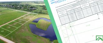
- A diagram showing the land plot and established boundaries.
- Text section - description of the site, its shape. The coordinates of turning or nodal points are also indicated here, which simplifies work on the ground.
- Description of the parts of the land plot, if it has any division. This includes a description of natural objects (reservoirs, hills, ravines).
- Schematic representation of the boundaries established by the engineer.
Why draw up a cadastral plan for a plot
This document is one of the most important to accompany the legal procedure for determining the territorial location of a land plot, because it reflects both schematic data and text information about the property and its owner.
State registration proves that the plot was included in a specially created register, the State Cadastre, where records of all existing real estate are kept. Thus, any legal transactions with land are officially legal.
One of the most important functions of a cadastral passport is that it confirms the owner’s ownership of the plot. The first section of the document indicates all information about the owner, as well as the grounds for assigning a cadastral number.


