Land surveying - what it is and the history of the development of the process
So, what is land surveying in simple words? Land surveying is the determination of boundaries and the process of legal registration of a plot of land on the ground. The processes of determining the boundaries of plots in Russia have been carried out since the 16th century.
Until the 17th century, information about them was recorded in scribe books. In the 19th century, special survey journals appeared, information in which was entered by specialists called land surveyors.
In the same century, a surveying institute was opened in Moscow, where surveying specialists were trained.
Large-scale work to determine the boundaries of land ownership in the Russian Empire began to be carried out in the process of agrarian reform by A.P. Stolypin. From this moment on, a definition is established: land surveying is the basis of the state cadastre of land real estate.
Is land surveying necessary? According to modern standards, land surveying is not a mandatory procedure, and registration of land rights with government agencies can be carried out without defining clear boundaries.
The basis for registration can be any document confirming a citizen’s rights to land (will, purchase and sale agreement, act of granting land by the authorities, etc.). But based on these documents, it is impossible to establish clear boundaries and geographical coordinates of the site in relation to other lands.
In addition, the main result of the land surveying process is the registration of the site with cadastral registration. The owner receives an official document confirming his rights to the land.
Without this paper, it is impossible to carry out transactions on its alienation with the plot. Thus, land surveying is not a mandatory procedure, but desirable.
So, we have considered the question of land surveying - what it is, then we will talk about the laws that are devoted to this procedure.
Modern legal norms
Today, the Russian Federation has developed a clear legislative framework regulating land relations. At the federal level, issues are regulated by the Land Code of the Russian Federation and Federal Law No. 221 “On the State Real Estate Cadastre”.
This document clearly outlines the procedure for land surveying.
Significant amendments were made to the law in 2020, when the law on dacha amnesty came into force in the Russian Federation, which introduced changes to the conditions for the provision of land and new ways of registering rights to them.
Goals and types of procedure
What does land surveying provide? This procedure is carried out at the initiative of the owner or by court decision. The owner needs to carry out the work for the following reasons:
- registration of own rights to land;
- obtaining a land certificate for subsequent transactions with it;
- division of a plot or its combination with an adjacent one;
- land privatization;
- registration of territory for rent.
The procedure can be carried out by court order to resolve land disputes. In this case, the court appoints a land management examination.
Depending on the goals, the following types of land surveying are distinguished:
- Division of a plot is carried out by agreement of the owners who own the plot jointly. With this type of land surveying, one common territory is divided into equal shares to determine new boundaries for each.
This type of land surveying is necessary when buildings belonging to different owners are located on the same land. One of the types of dividing land survey is the allocation of part of the land from a common plot that remains indivisible.In this case, the boundaries of the original land ownership remain the same, and the allocated parts are registered in the cadastral register as separate objects.
- Clarification of boundaries is a type of land survey when the boundaries of previously registered land are expanded by the norm established by law. Such surveying is necessary for the subsequent unification or division of the site.
Registration of a land management file is necessary for citizens in the following cases:
- If a dispute arises with neighbors.
- When you receive a plot as an inheritance and a dispute arises with other heirs.
- During general development of the territory on which the land is located.
- If you plan to build an expensive building.
- If the site has a complex configuration.
Pros and cons of the procedure
When considering whether or not to carry out land surveying work on 2 plots of land, you should take into account the following positive aspects of the process:
- allows you to increase the size of the existing plot by 10%;
- protect the borders of the land from encroachment by unauthorized persons;
- establish clear boundaries of your own territory;
- resolve disputes with neighbors.
The disadvantages include the need to spend money on registration, the possibility of disputes and even litigation with neighbors, the impossibility of re-registering the land to another person until the survey work is completed.
Land plot: concept and main characteristics
The concept of “land” is not just a topic for theoretical speculation. Understanding this issue affects the implementation by citizens and organizations of a large number of their rights. Moreover, there is a difference between the owner and various types of users.
Terminology
The concept of land is not that complicated. Nevertheless, significant changes have been repeatedly made to the relevant article of the Land Code.
In Russian legislation, the following term is used - a part of the earth's surface that has a number of characteristics that make it possible to identify it. The law directly indicates the status of the site as a thing.
What signs distinguish the site
Not every piece of the Earth's surface can be classified as a land plot, but only one that has been assigned the appropriate status. Today, the concept of a land plot includes lands that have the following characteristics:
- assigned a cadastral number;
- they have been assigned an address;
- boundaries are marked, area is calculated;
- the purpose and type of permitted use are indicated;
- economic characteristics are determined, including value expressed in monetary form;
- fertility indicators are calculated (affects agriculture);
- availability of real estate on the land plot.
The law provides for the mandatory entry of a whole list of information about real estate objects. If we talk about copyright holders, this is one of the main requirements.
Types of land plots
The legislation considers the following categories in the distribution of land:
- land for agriculture;
- lands for settlements;
- lands on which special objects are located (reserves, other environmental areas);
- lands allocated for forest and water funds;
- reserve lands;
- lands allocated for industrial, electric power, transport and other facilities.
Classification helps to fully disclose the concept and types of land plots.
This list refers to the intended purpose. At the same time, the country has adopted a classification of permitted use.
This includes: garden plots and summer cottage plots allocated for construction, etc.
The document was adopted much later than expected, due to which it was decided not to make any changes for areas whose purpose was designated differently than in the classifier.
Thus, the concept of a land plot includes many different objects that are not similar to each other, starting from a grandmother’s garden and ending with areas on which industrial enterprises are located. However, the rights to exploit them are determined by general legislation.
The concept of land rights
The Land Code, one way or another, mentions a whole list of land rights or opportunities transferred to citizens, within the boundaries of which they have the right to use the existing territory.
Some of them exist thanks to previously issued regulations that are no longer in effect.
The right always remains in effect, and the citizen has the right to dispose of it at his own discretion, and they are also protected by law. The following types of rights are distinguished:
- unlimited free use;
- free use for a certain period of time;
- right of lifelong inheritable ownership;
- easements - the legal use of someone else's property;
- ownership;
- lease right.
With the exception of the last two, these forms of land rights are not mentioned in any other acts other than those related to land legislation.
Right of use
It can be given to people and organizations. The law established that the owner makes the decision. If it is a state or municipality, then the allocation of land is made on the basis of a decision or order of the authority. Then a use agreement is signed with the owner. If the owner is a private person, then only an agreement is signed.
In Art. 39.10 of the Land Code lists cases in which plots are transferred for use. It also stipulates the maximum possible terms for concluding a contract in each case.
Article 39.10 sets out a rule obliging organizations and associations created for vegetable gardening or horticulture to carry out cadastral and boundary work, and plan the development of the territory. Only authorities and municipal and state organizations have the right of perpetual use.
Inherited ownership
To some extent, this right is similar to the right of ownership, but with certain restrictions. For example, there is no right to dispose of land at will (sell, exchange).
Permitted to use only under the conditions agreed upon when transferring the site. It is only allowed to transfer an object by inheritance.
As stated above, this right is retained, but it is not available to anyone other than the direct heir.
Easements
This includes the right to use someone else's property under specified conditions. What does this mean? For example, the right to pass or lay communications through someone else's land.
Private and public easements are provided. Private – provided by agreement of the parties to the relationship.
Public – provided by force of law, decision of an authority in order for the state to exercise its powers or interests of an indefinite number of citizens.
If it is not possible to resolve the dispute through agreement, a claim is filed in court. Termination of an easement is possible either by court or after the seizure of a land plot through redemption or confiscation.
Own
It includes all powers to exercise rights to a land plot as an object. The concept of property concerns both possession, use and disposal.
Purchased in several ways:
- make a deal;
- transfer of ownership upon application free of charge (in cases listed in the law).
The owner has the right to do what others are deprived of. At the same time, he remains obligated to use the site taking into account the intended purpose and interests of other persons (neighbors, easement owners, etc.).
Rent
It refers to the paid use of a site transferred for temporary use. The agreement specifies its validity period. If for some reason the clause was not agreed upon, it is considered that it was concluded for 5 years. The conditions may provide for the extension of the contract when the parties perform certain actions (application for extension or termination of the contract).
The Land Code does not provide a separate concept of renting a land plot. Art. 22 of the code describes the boundaries of the tenant's rights, for example the period and scope of rights that are allowed to be transferred to third parties.
Features of its implementation in the case of a mortgage, when signing an agreement on the integrated development of the territory, etc. Permission is noted to transfer the lease right to the authorized capital, mortgage it, and use it in another way.
If the lease term is more than 5 years, then coordination of the use of the site with its owner is required.
Finally
The land has never lost its value as a property. The concept and types of rights to land plots cannot be attributed to the subject of theoretical speculation only.
The law establishes a number of forms for the implementation of rights to land; they are quite specific (for example, the right of use).
The law provides for situations of using land without allocating it or concluding an agreement regarding its use.
The implementation of any right works according to two schemes:
- signing an agreement if the transaction is concluded between private individuals (people or organizations);
- signing an agreement based on an order from an authority.
In court, during the proceedings, both the legality of the order and the legality of the contract are assessed.
Source
Source: https://zakon.temaretik.com/1434685383696976003/zemelnyj-uchastok-ponyatie-i-osnovnye-harakteristiki/
Who carries out land surveying and how?
Only specialized geodetic companies can carry out measurements with subsequent preparation of documents, the choice of which can be handled by the owner. Before drawing up an agreement, it is worth checking whether the company has a license to carry out cartographic and geodetic work.
The organization must have special equipment, without which it is impossible to carry out land surveying.
Calculations and documentary recording of the boundaries of the site can be carried out by certified cadastral engineers; it is impossible to draw up the necessary papers on your own. According to legal requirements, the specialist carrying out the work must meet the following requirements:
- Citizenship of the Russian Federation.
- Higher specialized education.
- No current criminal record.
- Availability of Rosreestr certificate.
REFERENCE. In the Russian Federation today, 40 thousand CIs are registered and have Rosreestr certificates. Information about them can be obtained on the Rosreestr website (https://rosreestr.ru/wps/portal/ais_rki). From this list, you must select an engineer located nearby and affordable.
The site surveying procedure consists of the following steps:
- Concluding an agreement with a geodetic organization and transferring a package of documents:
- identification document;
land document;
- cadastral passport of the plot;
- power of attorney if the survey is not carried out by the owner.
- Notifying neighbors of the intention to carry out land management work. The notice must be in writing and must be signed by the neighbors.
If it is not possible to contact neighbors, notification can be sent by registered mail. This procedure can be contractually entrusted to an intermediary organization that has similar powers.If the address or location of neighbors is not known, or the site is located in a remote area, CIs must place an announcement about the proposed land survey in local media and on the website of the settlement administration.
The announcement is posted 30 days before the procedure. A copy of the newspaper with the published advertisement is attached to the survey file.
- Departure of cadastral engineers to the site. They define the boundaries of the site. If possible, neighbors are surveyed to determine their consent to determine the boundaries of land ownership.
- Obtaining a land survey document from a surveying company. At this stage, interaction with the survey organization ends.
- Contacting the organization that regulates land issues to approve a ready-made boundary plan. This document is prepared in the form of an A-4 format journal and reflects all the information about the site.
- Registration of land plot for cadastral registration.
IMPORTANT. If the boundaries of the plots were significantly changed during land surveying, each owner of the plot must obtain a new Certificate of Ownership from Rosreestr.
The contract is a prerequisite for taking measurements. In this way, the customer can insure himself against possible errors during the work.
Izhs plot is: concept, distinctive features, advantages of ownership
The legislation of the Russian Federation divides plots within the borders of the country into various types and categories, depending on the possibility of their intended use. One of the types of land plot is an individual housing construction plot - this is land intended for the construction of a residential building with the possibility of being used for sole residence.
A plot for individual housing construction is
Individual housing construction plot is an abbreviation (abbreviation) indicating the permitted use of the land (intended purpose).
Plots of individual housing development mean land on which there is already or is planned the construction of a property belonging to the housing stock for sole use by one family.
The use of a land plot called individual housing construction for the purpose of construction is possible only if it is located on a territory with cadastral specialists classifying it as “land of populated areas”.
Distinctive features of individual housing construction of land
In accordance with urban planning standards, the type of land plots, called individual housing construction, are plots whose use is permitted for the construction of the following residential real estate objects:
- individual buildings;
- buildings for utility purposes and structures for personal services for residents (bathhouse, cellar, garage, workshop, etc.).
At the same time, the main distinguishing characteristic of individual housing construction land from private subsidiary plots (for farming for subsidiary purposes) is the prohibition of breeding and keeping agricultural livestock and poultry on the plot. In addition, plots intended for residential development are strictly prohibited from being used for commercial purposes (to accommodate a store, mini-hotel, hostel).
Individual housing construction is characterized by the allocation of a plot exclusively within the boundaries (or in close proximity to them) of administrative-territorial entities - settlements.
Documents for plots of this type must indicate the intended purpose of the land - for individual housing construction. Otherwise, the house or other structure may be considered illegal.
The residential property itself must have an appropriate location relative to other objects:
- The minimum distance is 5 m from the red line of the streets.
- Location from 3 m to the red line of passages.
- From 3 m to neighboring buildings.
Important! If the construction of a residential building is carried out on individual housing construction lands, then such an immovable object cannot have the status of an “apartment building”.
Individual housing construction is settlement land, which should be used only for the construction of an object with the following characteristics:
- having no more than 3 storeys;
- intended for residence of an individual family;
- have a separate location from other buildings.
When building on individual housing construction lands, it should be taken into account that the design of a residential building must be developed and approved by a specialized legal entity. a person who has the appropriate license to draw up and execute project documentation, as well as SRO access.
Such a document is agreed upon in accordance with the procedure established by law with the regulatory authorities of local authorities through registration and issuance of a construction permit.
After a housing project built on a plot for individual development is put into operation, its owners have the opportunity to register themselves at the place of residence (registration) in this residential property.
Procedure for registration and alienation
Lands used for housing construction on an individual basis can easily participate in civil circulation, i.e. be the subject of purchase and sale, mortgage (mortgage of real estate), rent, exchange, donation and other transactions not prohibited by the Civil Code of the Russian Federation.
In the case of acquiring land for individual housing construction, special attention should be paid to the following nuances:
- a plot with the specified permitted use, as a rule, cannot have an area of more than 25 acres (this size is typical for plots located in rural areas);
- a single individual housing construction property within the city limits does not exceed the size of 10-15 acres;
- for urban-type settlements, the allocated land area for individual housing construction is a standard of 15 to 20 acres.
It is important to know that the sizes given are approximate and the most common in the constituent entities of the Russian Federation. Local authorities are vested with independent powers to establish the maximum and minimum sizes of land plots allocated for individual housing construction in each specific region of the country.
A legal analysis of cadastral documents for land for individual housing construction should indicate the absence of any restrictions on the use of the site, its encumbrances with red lines (high-voltage power lines, gas pipelines, railway tracks), development within which is prohibited by law.
Otherwise, transactions involving the registration of land with the specified use are no different from other categories of plots. The only peculiarity can be considered the allocation of land to individual housing construction for rent for construction.
In this case, construction must begin no later than 3-5 years from the date of signing the lease agreement, otherwise the land is subject to seizure from the tenant.
Upon completion of construction and registration of rights to the house, its owner has the right to purchase the land under the house at a reduced price depending on how long it has been used.
In many constituent entities of the Russian Federation, there are programs for the free provision of land plots for personal construction to citizens identified as needing to improve their living conditions, large families and other preferential categories.
Why individual housing construction
Land plots of individual housing construction are endowed with numerous advantages, such as:
- at individual housing construction sites, it is possible to assign a postal address to the object and register registration in the form of a stamp in the passport at the place of permanent residence;
- there are no legal restrictions for the construction of an individual residential property;
- placement of individual housing construction lands within the boundaries of settlements or near their territory (aul, village, urban district, settlement) provides their owners with access to infrastructure (trade pavilions, asphalt roads, kindergartens, schools, hospitals, pharmacies, post offices, etc.), to unhindered connection to communications and utility networks (electricity and gas supply, sometimes central sewerage and water supply);
- it is possible to obtain a tax deduction for construction;
- the possibility of registering a plot as collateral for mortgage lending;
- the presence of federal and regional programs to support housing construction on individual housing construction lands, allowing citizens to obtain ownership of housing on preferential terms.
At the same time, there are many positive aspects; land plots with permitted use for housing construction also have a number of negative qualities:
- high interest rates on land tax;
- often inflated cadastral value of land properties;
- the size of such plots is limited by regional legislation (each subject sets the maximum possible area for allocation, and in more prestigious places for living such a standard has a lower value and higher cost);
- a ban on organizing the residence of two (even related) families;
- to register land as legal possession (registration of property rights in Rosreestr), it is necessary to build housing on it within a period of 3 to 5 years;
- If an unfinished construction project is placed on individual housing construction land for a period of more than 10 years, the tax rate for such land increases by more than 2 times.
Cost and terms
The price for land surveying work is determined on the basis of:
- Labor intensity calculated using a special table.
- Standard hour prices calculated based on the engineer’s salary.
It is impossible to calculate these figures on your own, so the price must be determined through telephone conversations with specific specialists. In addition, the price depends on the specific region where the land is located.
The average price for the services of cadastral engineers is 10 thousand rubles for land management (is it possible to carry out land surveying for free?)
The time it takes to complete a case depends on specific circumstances, the terrain of the site, and the engineer’s workload. On average, production takes from one to three months.
Special cases of land surveying
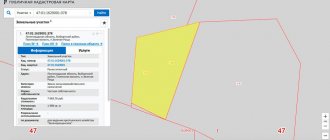
In the practice of land cadastral registration, there are situations when, according to documents, 2 plots overlap each other. This arises due to the imperfection of the legislation, which obliges to carry out coordination with those neighbors whose plots are registered in the cadastral register. The overlap occurs due to the engineer's errors in drawing up the plan.
When performing land surveying, the coordinates of the border points of neighboring areas are incorrectly determined. The boundaries of adjacent areas are violated, and documents overlap one another.
With mutual consent of the owners of such plots, the issue of determining the boundaries of each is carried out administratively.
By agreement with the neighbors, a cadastral engineer is called and takes measurements of two plots at the same time, for each of which a separate plan is then drawn up and a separate land management file is opened. Information about changes in boundaries is submitted to the cadastral chamber.
If a neighbor believes that the boundaries of his property are determined correctly and does not agree with the adjustments being made, the issue will have to be resolved in court. The defendants in the lawsuit will be the neighbors and the cadastral engineer who made an error in the calculations.
In the case of land surveying of land management objects. New boundary plans are drawn up by court decision. In this case, coordination with neighbors will not be required.
The process of land surveying is not forced in the Russian Federation, and each landowner has the right to independently decide whether it is necessary. However, the presence of official documents will save the owner and his heirs from possible problems.
We hope that our article helped you understand the question of what land surveying means.
What to do when reducing area
Reducing the area of land is possible in two cases :
- When correcting a cadastral error. Moreover, according to Order of the Ministry of Economic Development No. 943 of 2020, the initiative to correct a cadastral error can come not only from the owner of the plot, but also from Rosreestr.
- When a claim arises from neighbors who carried out land surveying, according to the results of which the border of their site runs along an adjacent plot.
This is interesting: Land tax under the simplified tax system
In any of these cases, the site owner has 2 ways to solve the problem:
- Agree with the reduction of land and sign the deed of approval of boundaries.
- Do not agree with the reduction and order clarification of the boundaries of the land plot.
If the clarification procedure does not give the desired result, you can file a claim in a court of general jurisdiction , which will appoint a judicial land management examination.