Date of uploading information from the State Tax Register, what does this mean?
Of course, this is not an exhaustive list of required papers; in each case, it can and will be slightly changed, referring to what changes are being discussed.
At the same time, the subsequent date of change in information in the State Tax Code and what this means is not a very complicated question. Since Rosreestr is obliged to make amendments to the database within a maximum of ten working days after the applicant’s application, the register displays the date when the amendment was made (within these ten days). Technical errors are corrected by Rosreestr either on its own initiative, if it independently discovers them, or based on a submitted request from the outside. The period for making changes is no more than five days from the date of filing the application or the date of the court decision (depending on the circumstances).
Grounds and procedure for making changes to the cadastral passport of a real estate property
A cadastral passport is included in the package of documents proving the right to a certain property. Until the 1990s, only technical passports were registered for the premises, but now, when drawing up contracts, it is mandatory to have cadastral documents on hand. Therefore, any property owner needs to do them. And if they already exist, then find out about making changes to the cadastral passport of the property. It includes apartments, houses, separate rooms, and outbuildings, which must be registered in the cadastral register.
Reasons for making changes to the cadastral passport
Any change in these documents must be justified. They may be needed for various reasons. All data in the papers must be current, otherwise real estate transactions will be considered invalid. Purchase, sale, donation or inheritance - these processes must be carried out in accordance with all the rules, therefore any real estate must be registered.
Making amendments can also affect the recalculation of the tax; after new information appears in the State Tax Tax Tax Code, the difference will be reimbursed to the property owner.
The reasons are usually:
| Changes for land | area variation |
| addresses or locations | |
| cadastral price | |
| owner | |
| if resources (forest, reservoirs, etc.) have disappeared or appeared on the territory | |
| For apartments, premises or non-residential facilities | variation of technical parameters |
| location | |
| cadastral value | |
| functionality of the room | |
| property names |
Replacing the cadastral document may still be necessary when there is a change of owner. However, for this you need to collect too many new papers, it is unprofitable to dispose of the old passport and completely change it. Therefore, only information about new owners is updated. After some time, the passport is returned to them.
Amendments must be made every 5 years. However, if they were not there, then updating the documents is not required. But it is also important to remember that if any errors are detected in the characteristics, personal information about the owner or other items, it is necessary to redo the cadastral passport, otherwise it will be declared invalid.
The construction of any buildings on the territory of the land plot or the redevelopment of an apartment also requires updating the data in the cadastral passport. It is necessary to call an engineer to make the required amendments; they should be included in the document.
Damage is another reason for changing your passport. Worn, exposed to water or other liquids is a necessity to apply for document restoration.
Who is eligible
Relatives of property owners do not have the right to apply for changes or for a new passport. A statement signed by the owner is required. If there are several of them, then written permission from each of them is required. Otherwise, the corrections will not be entered and the passport will remain the same.
Where to submit applications
There are three ways to purchase a cadastral passport for any real estate:
- appearing at the cadastral chamber on your own;
- to the territorial department of the MFC;
- remotely through the public services portal or the Rosreestr website.
Each of them has its own procedure. However, regardless of the method of receipt, you must provide a package of certificates that are the same for all persons. It includes a citizen’s passport, documents for the building and payment receipts. If an application from the owner was submitted to the cadastral chamber or MFC, then he must fill out the form. After 5 days, you can receive a ready-made passport; for all submitted documents, the applicant is given a receipt, which, together with an identity card, is needed to issue a ready-made cadastral passport.
Citizens who are interested in the following questions can also find out information. They are usually associated with:
- categories of state land;
- the location of any property registered with the State Property Committee.
Features of receiving via the Internet
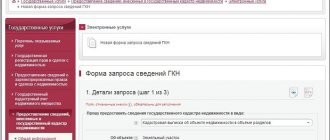
The remote method of registering an application and receiving it is considered very convenient. It has been available to every Internet user in recent years. To do this, fill out the necessary form on the website page. The “Receiving Documents” tab allows you to find out all the necessary information, such as the type and form of the document, and the location of the object. Filling out the form can be in the following forms: a paper version is sent by mail, or as an electronic file via the Internet by email.
Then it is important to fill out the data that opens after clicking the button and go to information about the applicant. You must agree to the processing of personal data, then click the “Send request” button. He will be given a number, after which a letter with a payment code should be sent to his email. It is easy to pay the state fee using a bank card, electronic wallets or through terminals. The cost of an electronic file is 150–300 rubles. It is sent to customers within 5 days.
What is GKN in Russia in 2019
- collection of necessary information regarding real estate objects;
- data systematization;
- turnover of rights that are registered in the state register;
- storage of information regarding the boundaries of settlements, between regions of Russia, land plots of various categories.
- the real estate objects themselves;
- the length of the Russian border line;
- current borders that can divide regions among themselves and settlements in particular;
- cadastral territorial division;
- zones of the territories themselves, as well as zones that include special land use conditions;
- numerous additional data directly on objects;
- various cartographic and geodetic information.
The procedure for making changes to the state real estate cadastre
- change in the area of the land plot;
- change of address or location description;
- change in cadastral value;
- the appearance or disappearance of new objects within the boundaries of the land plot;
- change in the category of land or purpose of real estate;
- change of name;
- establishment of restrictions on property rights (encumbrance);
- completion of construction.
- Document the changes that have occurred.
- Receive an extract from the cadastre confirming the non-compliance with the existing situation (paid service).
- Contact Rosreestr with an application and required documents.
- Obtain a new cadastral passport for the property.
What changes are being made to the real estate cadastre and cadastral passport?
Of course, cadastral data is many-sided and varied. There is numerical, graphic and text information. Accordingly, it is entered and changed in different ways, depending on the species.
Changes made to land plots:
- clarification of the boundaries of the land plot. If the boundaries are not established in accordance with land legislation (there was no land surveying, but there is a cadastral passport) or the boundaries have undergone changes after the cadastral registration. In addition to the boundaries, the area of the land plot is also specified.
- correction of cadastral error. If the boundaries or area of the land plot are entered incorrectly into the cadastre. That is, land surveying has already been carried out, but the data is erroneous.
- technical error correction. Most often, the human factor is the employees of the Cadastral Chamber.
- change of address of the land plot. Based on decisions and regulations of the municipality or government agency.
- changing the category of land and permitted use. Also basic are the documents of authorized bodies.
- change in cadastral value. Most often, by court decision after an independent assessment initiated by the owner. Naturally, the cost comes out lower. But the state is not asleep, and every year it independently revaluates real estate upward. Such are the assessment battles.
- removal from cadastral registration. The accounting object ceases to exist.
Don't be confused
making changes to an existing land plot with merger, division or redistribution. In this case, no changes are made to the original land plots, but they are deregistered.
Changes made to real estate (buildings, structures, premises):
- any unique characteristics of the object (address, coordinates, area, etc.). Entered through the technical plan.
- purpose of the building (apartment, residential, non-residential), premises (residential, non-residential), structures
- type of living space (apartment, room)
- number of floors (building or structure)
- external wall material
- main characteristics of the object (height, length, etc.)
- name of the building, structure (if such name exists)
Need to pay attention
that when changing the owner and registering the right to a property or land plot, there is no need to submit an additional application to the cadastral chamber. Everything can be done in one go. After some time, after submitting the application, you can receive a fresh extract from the Unified State Register - the owner must update.
GKN information: changes and their dates
The applicant, when applying in person, must, among other things, have a passport or other document proving his identity (military ID, international passport). When sending by post, this document in the original is not placed in an envelope; a copy certified by a notary is required.
They have the right to suspend the process if there are any inconsistencies in the information displayed by the documents available in Rosreestr and the data submitted by the applicant. Also, the procedure will be delayed when, in a situation with land plots, the boundaries of one overlap with the boundaries of another (most likely, you will have to order a repeat land surveying procedure). Lack of required papers may also cause the procedure to be suspended. In any case, the applicant will be notified of the decision and the reasons for it and will be advised what needs to be done to lift the suspension.
We recommend reading: Gu FMS Ministry of Internal Affairs of the Russian Federation
What to do if you need to make adjustments and changes to cadastral registration
In life, it often happens that information regarding a property or land plot no longer corresponds to reality. In such a situation, it is necessary to resort to making changes to the cadastral registration, otherwise the discrepancy in information will not allow the owner of the land plot or real estate to make legal transactions on it, as well as to exercise other property rights.
For example, the owner changed the type of use of his land, but forgot about making changes to the cadastral registration of the land plot. Then the Federal Tax Service will not make a timely recalculation of the land tax, and this is especially critical if the tax was supposed to decrease.
When do changes need to be made?
In any of the situations discussed below, appropriate changes will need to be made.
For a property, including a separate premises, this will be needed if the following has changed:
- main technical parameters (number of floors, area or height of the building, or building material from which load-bearing walls are made, etc.);
- address;
- destination type;
- the value of the property according to the cadastre;
- name of the building;
- stage of readiness of the real estate object under construction.
For the ground, if it has changed:
- its value according to the cadastre;
- allotment area;
- address;
- ownership information;
- classification of land plot or type of use;
- a forest, a pond and other types of natural objects located on the earth appeared or disappeared.
These are the main reasons for making changes to cadastral registration.
How to make changes: step-by-step procedure
Firstly, you need to officially document all changes affecting the property or land. To do this, you need to take a stamped extract from the local Cadastral Chamber and check whether the real parameters of the property really diverge from the data indicated in the cadastre.
After this, you need to find out who has the right to apply for changes to the cadastral passport of a real estate property or plot of land. By law, making changes to the cadastral registration of a property is the prerogative of the owner or his authorized representative.
A property owner who wants to change his cadastral passport must go to the local Chamber or MFC unit. But personal presence is not necessary here, since you can simply send all the documentation necessary for the land plot by mail or online by going to the government services portal.
Despite the breadth of opportunities presented, the most reliable option is to appear in person at the accounting authorities, because:
- this will save money (when sent by mail, all documentation must be notarized, in addition you will have to pay for post office services);
- it will be possible to immediately consult on all issues, and if errors and inaccuracies are identified in the papers, due to which the registration request will be rejected, they can be corrected instantly, and this will save time;
- no additional technical devices, such as electronic signature equipment, will be required.
For this reason, in the future, when we talk about how to change the cadastral passport of a land plot, we will mean transferring the package of documentation directly to the government agency that carries out the registration.
What documentation needs to be submitted to the accounting authorities?
- General passport to confirm the identity of the applicant. When documents are transferred by his authorized representative, a notary’s signature will also be required. In this case, the passport and certified power of attorney must be given along with their photocopies. You just need to show the passport itself, and leave a photocopy of it with the employee.
- An application drawn up according to the established template.
The application form can be obtained from the Chamber conducting the registration, and the institution’s staff can be asked to help fill it out correctly. Also, a sample application for making changes to the cadastral passport of non-residential premises can be downloaded on the Rosreestr portal in the subsection of the same name. The application is filled out in the presence of an employee of the organization conducting the registration. You should write your contacts in it, including your phone number. Then, if unexpected difficulties and obstacles arise, you will be called immediately. - In order to make changes to the cadastral passport of a land plot, you will need papers confirming the fact of ownership of the property. As a rule, for this it is enough to have the appropriate certificate, but you can also transfer the purchase and sale agreement, registration certificate, etc. to the registration authority.
- Papers that kept records of all changes occurring with the property, including:
- Boundary plan (for land).
- Technical plan (for buildings and sites).
- Resolution of the institution conducting the registration on the transfer of land to another subcategory.
- The decision of the municipality conducting the registration to change the type of land use.
- The decision of the municipality carrying out the accounting to change the purpose of a building or structure, etc.
The authorities responsible for accounting need to show the original papers and provide photocopies of them.
However, citizens do not have to pay a fee. The employee who accepted the documentation package will give a receipt indicating the day the documents were submitted, their complete list and the day by which the information in the cadastre will be updated.
Deadlines
The duration of entering adjustments into the cadastre after the transfer of the documentation package cannot exceed 18 days. When transferring a package through the MFC, adjustments are made within a maximum of 21 days.
By the date specified in the receipt, you need to personally come to the organization conducting the accounting, present your identity card and receive the corrected documents. After this, they must be transferred to Rosreestr to complete the procedure.
Refusal
Sometimes citizens are denied cadastre adjustments. The refusal can be appealed in court, but it is more prudent to take into account the comments made and resubmit the documentation.
Adjustment may be denied if:
- the application came from an unauthorized person who is not the owner of the property or who provided an incorrectly executed power of attorney;
- important papers are missing or the submitted documentation is completed with errors;
- making adjustments may violate Russian laws.
Source: https://MirKadastra.ru/kadastrovyj-uchet/izmenenie-kadastrovogo-ucheta.html
Discrepancies in information in real estate documents
That is, information about the technical characteristics of a real estate property contained in the State Real Estate Cadastre (GKN) is combined with data on registered rights to these objects, which were previously contained in the Unified State Register of Rights (USRE).
Hello! The technical passport of 1998 indicates the area of the apartment is 49.52 m2. The purchase and sale agreement contains 49.52 m2. Since then, no one has handled the documents. Currently, the Rosreestr website shows an area of 56.9 m2 (!) with a cadastral registration date of 2014. There is currently no line with information about the organization that entered the information (as in your example) in electronic form. The information was stored in the regional BTI. It is possible that they entered erroneous information. The inflated area of 56.9 m2 surfaced in the tax office in 2020 and, after interaction with the regional BTI, returned to 49.52 m2. But now, formally, the Rosreestre lists 56.9 m2 and the source of information is not indicated. Please tell me how to fix the error?
What documents are needed to make changes?
It should be noted here that there are documents that are always necessary, and there are those that are needed for each specific case.
- You always need: a passport, title documents for the object, a power of attorney (if required).
- Documents from the cadastral engineer: when clarifying the boundary, correcting a cadastral error, a boundary plan. When the unique characteristics of a property change, a technical plan.
- Documents from authorized bodies: when changing the address, category of land, etc. instructions for the entry into force of the changes must be submitted. For OKSs, if this does not concern redevelopment (for example, changing the address, name, type of residential premises), orders are again needed.
Amendments to the State Tax Code and the fight against suspensions of the Cadastral Chamber
Owners cannot make changes to the State Property Code on their own. The cadastral engineer creates a package of documents with the help of which cadastral registration is carried out, or changes are made to an existing cadastral number. Depending on the object, a corresponding package is generated. This is either a technical plan, or a boundary plan, or an inspection report of a land plot, a survey report, or a map plan, or a conclusion from a cadastral engineer. With the help of all these documents, the cadastral engineer will then be able to register the object for cadastral registration or make changes. Despite compliance with all these requirements, the Cadastral Chamber very often returns documents for revision or completely refuses further actions to make changes to existing objects. Let's figure out the reasons why documents are returned and how to avoid them.
The procedure does not require payment of a state fee; according to the law, changes are made free of charge. The small amount you are asked to pay is a fee for the document forms. On the date specified in the receipt, the owner or authorized person, with identification documents, appears at the territorial office of the state cadastre or MFC. And they receive a statement containing updated information about the object. After receiving it, the procedure is considered completed.
What does it mean that the information on public cadastral maps does not correspond to the information contained in the Unified State Register?
The parties accept the proposal, the cadastral error is corrected by court decision and the consent of both parties. Thus, it becomes clear that a cadastral error can be corrected either directly by the Registrar or by the court following a claim by an interested party. Also, corrections to the register can be made in the process of comprehensive cadastral work carried out by a cadastral engineer.
According to the procedure for maintaining the Unified State Register of Real Estate, approved by Order of the Ministry of Economic Development of Russia dated December 16, 2015 No. 943, before entering information about real estate into the federal state information system for maintaining the Unified State Register of Real Estate, the characteristics of each property contained in the Unified State Register and the State Property Register will be checked for complete coincidence. In the event of a discrepancy between the information of the Unified State Register and the State Register of Property Taxes on certain characteristics - information about the characteristics of the property that was entered into the State Register of Property Registers later than the date of registration of the right and in respect of which changes were not made to the Unified State Register due to the need to comply with the requirements established by the legislation of the Russian Federation for their change and in the absence of such confirmation, the status of “uncertified” is assigned, which will significantly complicate the performance of accounting and registration actions in the future.
We recommend reading: What Documents Are Needed to Obtain a Passport at 45 V MFC
The procedure for making changes to the cadastre
Only an employee of the State Cadastre can make changes, subject to compliance with the law. In case of a technical error, that is, a typo, clerical error or incorrect calculations, changes are made by the registrar (service employee) after independently discovering it or receiving a statement.
- transfer of ownership to a new owner;
- the area of the allotment has changed;
- new objects appeared on the land plot;
- change of address (when renaming streets, localities);
- change in land category;
- change in VRI;
- increase/decrease in cadastral value;
- cadastral engineer's mistake.
We recommend reading: Preferential pension for doctors
Making changes to the cadastre in 2020 | Legal Advice
Last update: 01/30/2020
Information about a property may change over time for various reasons. It is advisable to reflect such changes in the cadastre. Otherwise, the contradictions that arise may become an obstacle to transactions and other manipulations with real estate, or greatly complicate their completion, as well as negatively affect the implementation of other rights of the owner.
For example, a citizen changed the type of permitted use of his land plot and did not make changes to the cadastre. The tax inspectorate will not recalculate the amount of land tax (including downward) until the cadastre contains information about a new type of use of the land plot.
Changes to the cadastre must be made in the following cases:
Subtleties
It is necessary to distinguish changes in the cadastre from registration after the termination of registration of real estate and from the correction of errors.
Regarding the simultaneous deregistration and new registration, it should be noted that, as a rule, such situations arise during the global redistribution of real estate or when several objects are involved in the process. When making the necessary changes to the cadastre, only minor alterations occur.
For example, if as a result of the reconstruction of a building the area has increased by 10 sq.m., then of course this is a change in the cadastre.
If an extension to the building was erected, requiring separate commissioning, then the original building is removed from the cadastral register and the entire complex is staged at once (the older ones are the rear ones, plus the extension, as a single object).
Regarding the correction of errors, this is a special procedure provided for by law. Correction of errors is carried out either at the initiative of the cadastral authority, or at the request of any person, or by court decision. In any case, the authorized body makes a decision about the identified error and eliminates the error within five days, of which interested parties are notified.
Ordinartsev Roman Valerievich
How to make changes to the state real estate cadastre
The grounds for carrying out the cadastral registration procedure and registration actions are listed in Federal Law No. 218-FZ. It must be taken into account that from January 2020, these procedures can be carried out simultaneously or separately, it depends on the specific grounds for contacting the Rosreestr service.
The preparation of a technical or boundary plan is the responsibility of a cadastral engineer who has a qualification certificate and is a member of a self-regulatory organization. The algorithm of actions for drawing up an updated technical or boundary plan includes the following steps:
Cases of changes in information in the cadastral passport
Not a single law establishes a clear list of grounds on which it is possible to make changes to the cadastral passport of an apartment, as well as to the cadastral passport of a land plot. It is possible to generate examples of facts that could serve as a reason for changing the information already available in the passport only by relying on the practice of the cadastral service. It involves the division of bases into two groups. The first relates to the reasons for making changes to the cadastral registration of a land plot:
- if there have been changes in the value of land;
- change of address;
- changes in the area of the site;
- the appearance of previously absent objects on the site;
- change in the type and category of land;
- the emergence of new information that the right has become limited.
The second group of grounds that the cadastral service identifies is the one that includes the reasons for making changes to the cadastral passport of an apartment or other similar real estate:
- change in the main characteristics: floor, area, material, and so on;
- change of address;
- change of name;
- change in the price for an object according to the cadastre;
- change of purpose, type, category;
- change of construction stage.
In the activities of the cadastral service, other grounds may be identified, which are formed due to certain adjustments to the information available in the cadastral passport. That is, the types of changes are specifically defined. They relate exclusively to the description of the property, its value and purpose.
Recording changes is also necessary because timely correction of errors will avoid administrative or criminal liability.
It should also be noted that changing the owner of a plot or apartment does not entail the need to contact the cadastral service in order to change the passport of the property. All data about the new owner will be sent to the cadastre automatically, and only after a while it will be possible to order a new cadastral passport, but on the condition that any information about the object has been changed and requires correction.
Date of Changes in Information in the State Book of Accounts What is it
LLC Land Management Agency "Veles" offers you a full range of services for making changes to the information of the state real estate cadastre, starting from ordering and preparing the necessary documentation, and ending with receiving, by notarized power of attorney, a cadastral passport or an extract with the entered information about changes in the characteristics of your land plot.
6. Coordination of the boundaries of a land plot with adjacent land users (in some cases, coordination of the boundaries of a land plot must be carried out through the publication of an advertisement in the newspapers “Tyumen Region Today”, “Krasnoe Znamya”, Tyumen Courier”) - up to 1 month.
Making changes to the Unified State Register of Land Registers
Reading time 6 minutes Ask a lawyer
faster.
It's free! Font size:
A+ | A−
Owners of land plots in some cases may be interested in making changes to cadastral records that reflect information about real estate properties. Let's consider the features of the procedure for making appropriate changes, taking into account the specifics of regulatory legislation.
Where and by whom are changes made during cadastral registration of land plots?
Making changes to the cadastral passport of a land plot (more precisely, to the cadastral records, subsequently reflected in the extract from the Unified State Register of Real Estate, which since 2020 replaces the cadastral passport) is a procedure that is regulated by Russian legislation, on the one hand, in quite detail, but on the other hand, in many legal relations are not systematic enough. Given the abundance of legal norms, only an experienced specialist in some cases can apply those that are relevant and have the necessary legal force.
Changes in the Unified State Register of Real Estate about a land plot, upon entry of which an interested person can issue an extract from the register, similar in its functions to a cadastral passport, can be initiated:
- after carrying out internal departmental procedures (during which errors, inaccuracies, and additional information that must be reflected in the Unified State Register were identified);
- within the framework of interdepartmental cooperation. In this case, information to be entered into the Unified State Register can be transferred to Rosreestr by other state authorities, municipal structures, courts, and notaries.
Among the most common procedures that may become the subject of communication between Rosreestr and other departments:
- establishing the cadastral value of real estate;
- determining or changing the type of permitted use of the property;
- assignment of a land plot to a certain category.
- Other interested party.
Most often this is the owner of the land plot. At the same time, the final actions to make changes to the Unified State Register are carried out, of course, by Rosreestr, but, in this case, upon the request of the interested party.
Reasons for contacting the Rosreestr of the owner of a land plot in order to change information in the Unified State Register of Real Estate may be, for example:
- carrying out surveying of a land plot, upon completion of which information about its current boundaries is required to be entered into the Unified State Register of Real Estate;
- correction of an error in the register that was not identified in a timely manner by the department;
- the owner’s desire to change the category of permitted use of the site.
It is noteworthy that in all 3 procedures, court decisions can be the legal basis for making changes to the Unified State Register of Land Registration on a land plot.
But if interested parties and Rosreestr have no claims against each other, the necessary actions can be taken by the department within the framework of the general mechanism of interaction with applicants, which is regulated at the level of federal and departmental legal acts.
Let's study in more detail how to make changes to the cadastral passport of a land plot (officially - EGRN with subsequent confirmation of the changes in an extract from the register) in the 3 specified scenarios.
How are changes made to the Unified State Register of Real Estate during land surveying?
Strictly speaking, during land surveying, changes to the Unified State Register are not made in relation to existing records about the site, since until land surveying is carried out, information about it is not reflected in the corresponding register.
But in the context of land surveying, it is legitimate to interpret the concept of “changes in the Unified State Register” in a broad sense - as a change in the status of a certain territory in the Unified State Register (which, before land surveying, one way or another, should be reflected there in a different status provided for by law).
In order to survey a site and reflect information about it in the Unified State Register, the interested party generally performs the following actions:
- He turns to the cadastral engineer, who actually carries out the land surveying.
- Participates in the preparation of the boundary plan and the documents accompanying it (for example, the act of approving the territory of the site with neighbors).
- Submits the finished boundary plan to Rosreestr - directly or through the mediation of the MFC.
Next, Rosreestr takes the necessary actions to make changes to the Unified State Register. The interested party will subsequently be able to order an extract from the register, which, like the cadastral passport previously, will contain information about the plot.
How to correct an error in the Unified State Register of Real Estate?
There are 2 types of errors in the Unified State Register:
The first are those that represent a typo, typo, incorrect transliteration and other unintentional actions of Rosreestr specialists (which, at the same time, can be predetermined by failures in the department’s programs and equipment), and in this case the specialists will have nothing to do with it.
correct a technical error by sending an application to the department in the form put into effect by Order of the Ministry of Economic Development of Russia dated December 8, 2015 No. 920.
A registry error is more serious. It arises due to the presence of inaccuracies in the source documents, on the basis of which Rosreestr specialists make entries in the Unified State Register of Real Estate. For example, there may be an error in indicating the area of the plot in the same boundary plan.
To correct it, the owner of the land plot will need to order a new boundary plan and certify that it, unlike the previous one, is correct. This can be done in court.
Having a new boundary plan and a court decision in hand, the owner of the plot applies to Rosreestr with an application - this time in free form, to correct the entry in the Unified State Register of Real Estate.
Download an application to Rosreestr to correct a technical error (sample)
Status of cadastral information and its changes
The inspection protocol and the draft decision are sent to the authorized official for decision-making. This official has the right to change the inspection protocol, certifying the changes with his signature. The surname and initials of the authorized official of the CMO, as well as the date of signing the inspection protocol and making the corresponding decision, are entered in the AIS of the State Control Committee.
Cadastral information about the formed property is assigned the status “temporary” and the validity period of the specified information is indicated. Temporary status of information is not assigned in relation to created buildings, structures, unfinished construction objects and premises.
The procedure for making changes to the cadastre
The procedure for making changes to the state real estate cadastre is specified in the Federal Laws on the State Cadastre and is regulated by these regulations. There are several reasons for making corrections, all of which are set out in the legislation. The reasons for such amendments are external and internal.
- transfer of ownership to a new owner;
- the area of the allotment has changed;
- new objects appeared on the land plot;
- change of address (when renaming streets, localities);
- change in land category;
- change in VRI;
- increase/decrease in cadastral value;
- cadastral engineer's mistake.
What is the subject of change?
First of all, it is necessary to understand which objects are included in the state real estate cadastre.
- Land plots and their parts.
- Buildings, structures, premises - OKS (capital construction projects).
In the first case, changes are made by preparing a boundary plan of the land plot. Secondly, from a technical point of view. Both documents are prepared by a cadastral engineer. However, not all types of changes are made with the participation of an engineer.
Making changes to the state real estate cadastre
- Rosreestr will handle the state registration of real estate.
- bodies of territorial departments will receive documentation and applications from owners, which will subsequently be sent to the main body;
- territorial services also have the right to make amendments and make decisions, issuing information to citizens who contact them on paper.
First of all, in order to understand the entire sequence of actions, it is better to contact qualified lawyers who will be able to advise on a professional level on the issue of making changes to the cadastral passport of a real estate property and land plot.
Making changes to the cadastral registration of a land plot
- land owners;
- persons to whom the land belongs by right of inheritance;
- persons who have the right to unlimited use of the site;
- persons in whose favor there are restrictions and/or encumbrances on the land;
- representatives of the categories listed above who have a notarized power of attorney from them to carry out actions to make changes to the cadastre;
- Boundary plan (for those situations when changes are made to the parts describing the location of boundaries and area of the site).
- The original and a copy (notarized) of a document that confirms the resolution of a land dispute about boundaries (if the boundary plan does not contain information about the approval of the boundary in the required manner).
- The applicant's passport (as well as a notarized power of attorney if the documents are submitted by a representative).
- A document certifying the applicant’s authority to speak on this issue (if the State Tax Code does not indicate information about the registered right).
- The original document that establishes or certifies the applicant’s right to the land plot. When a document is accepted by the caducerate authority, a copy will be made of the document with the stamp “original presented.”
- A document that confirms the type of purpose (for those cases when changes are made to this part of the land information).